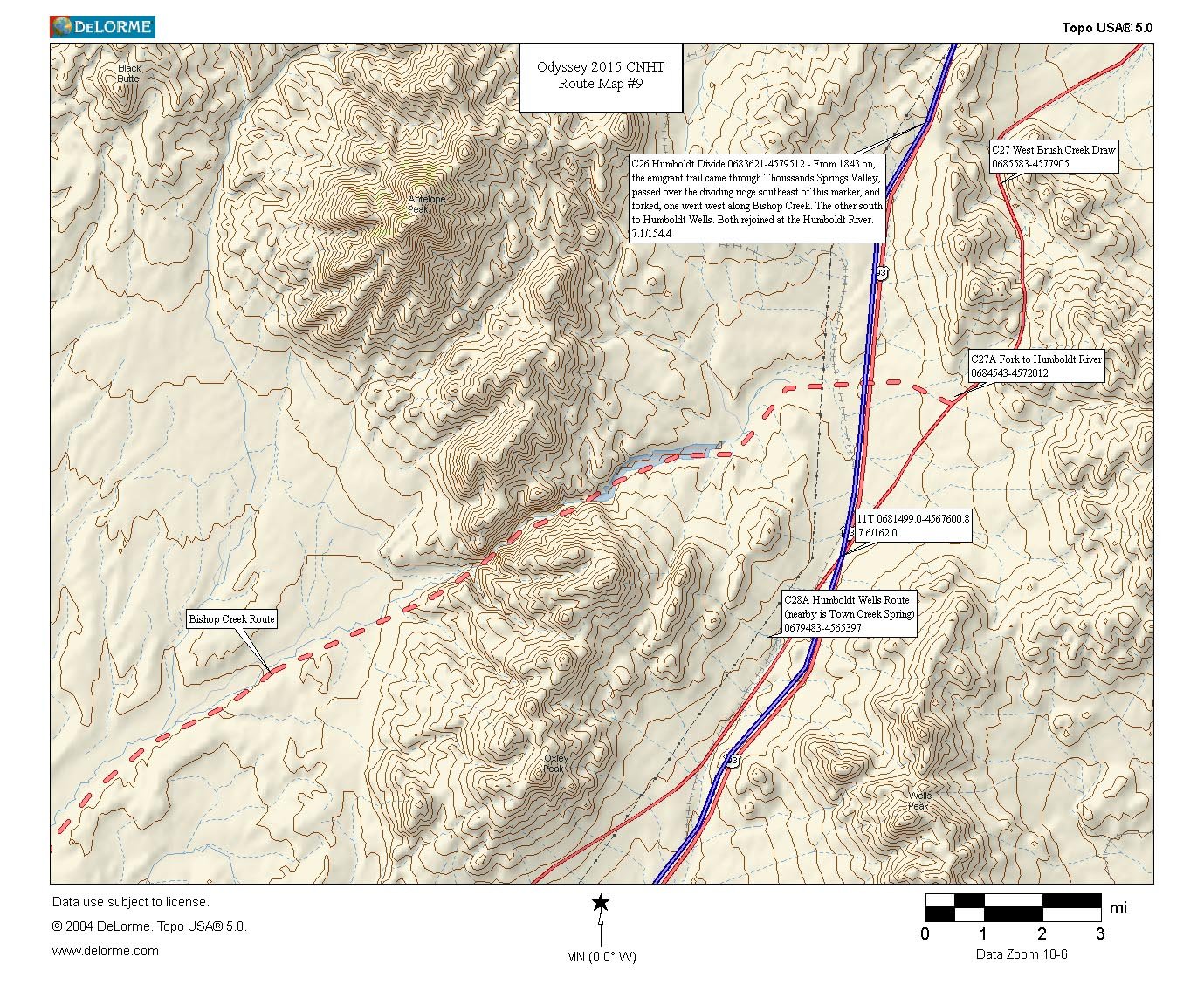
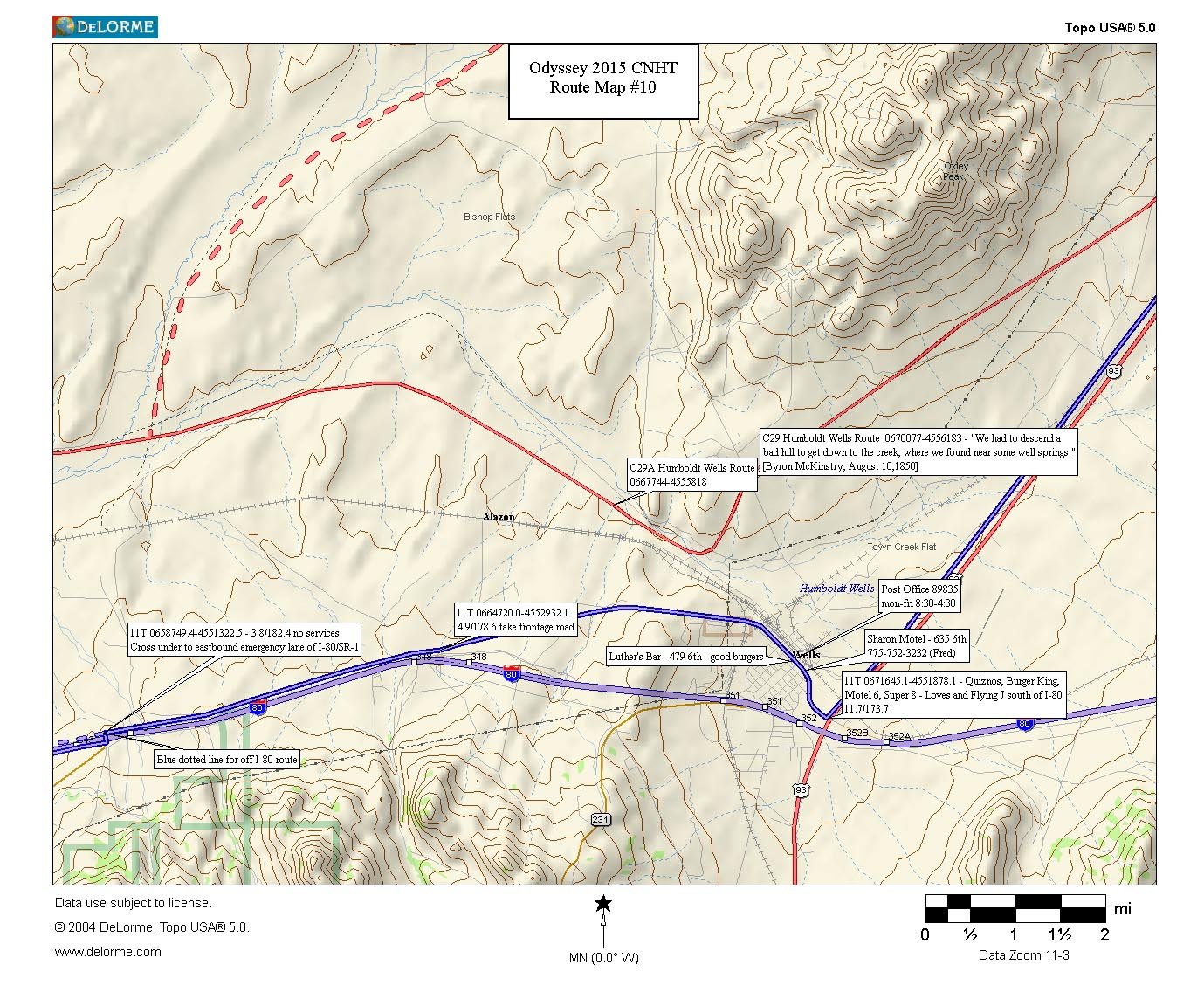
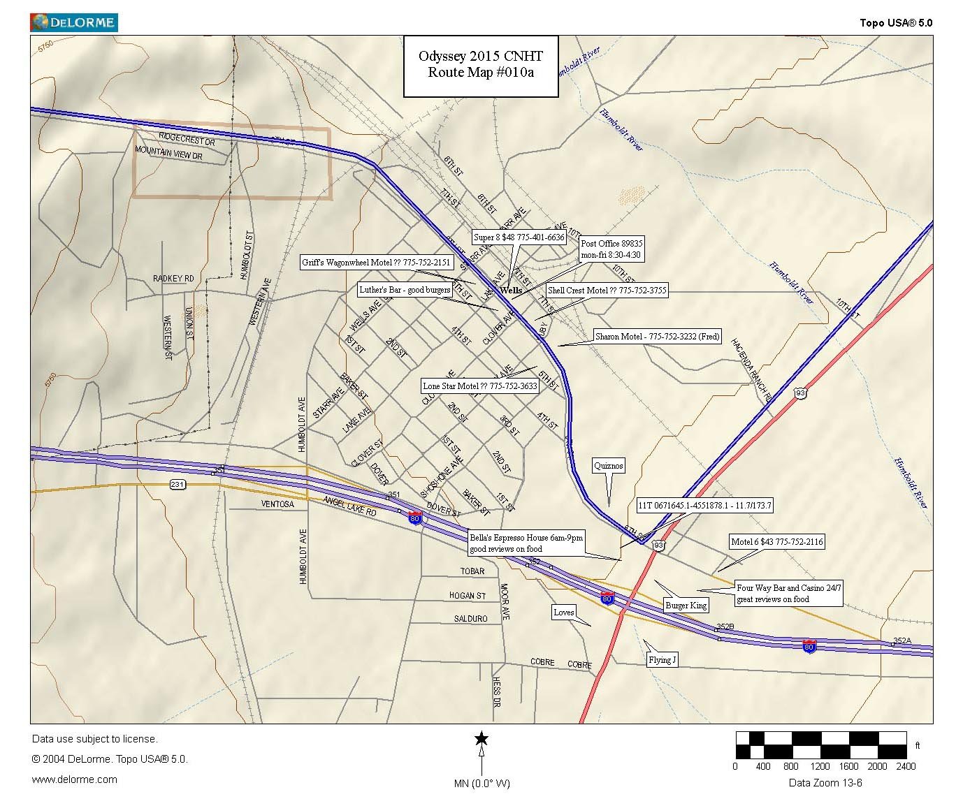
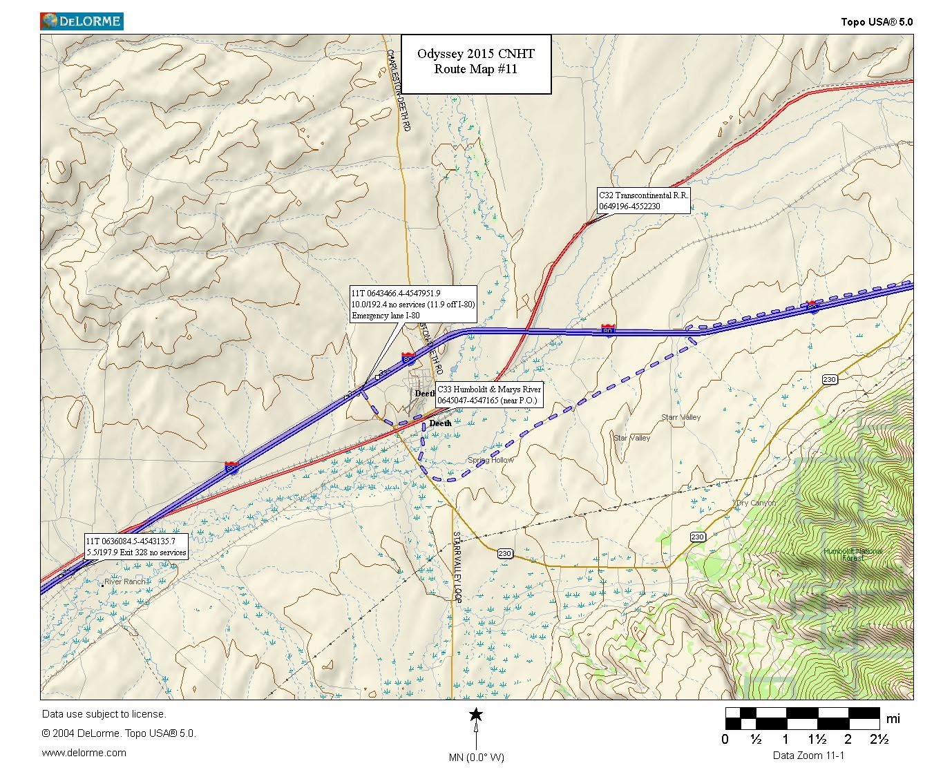
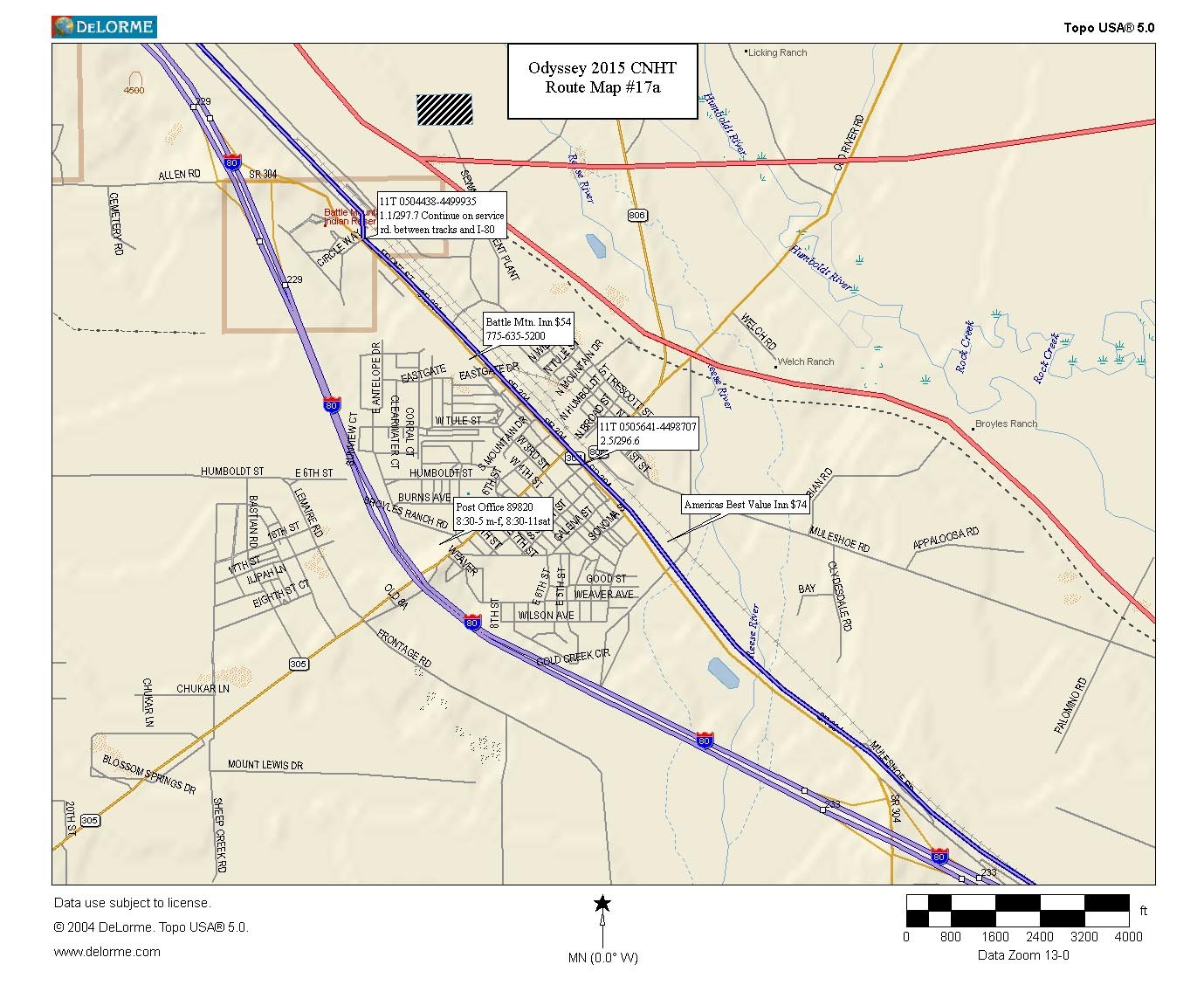
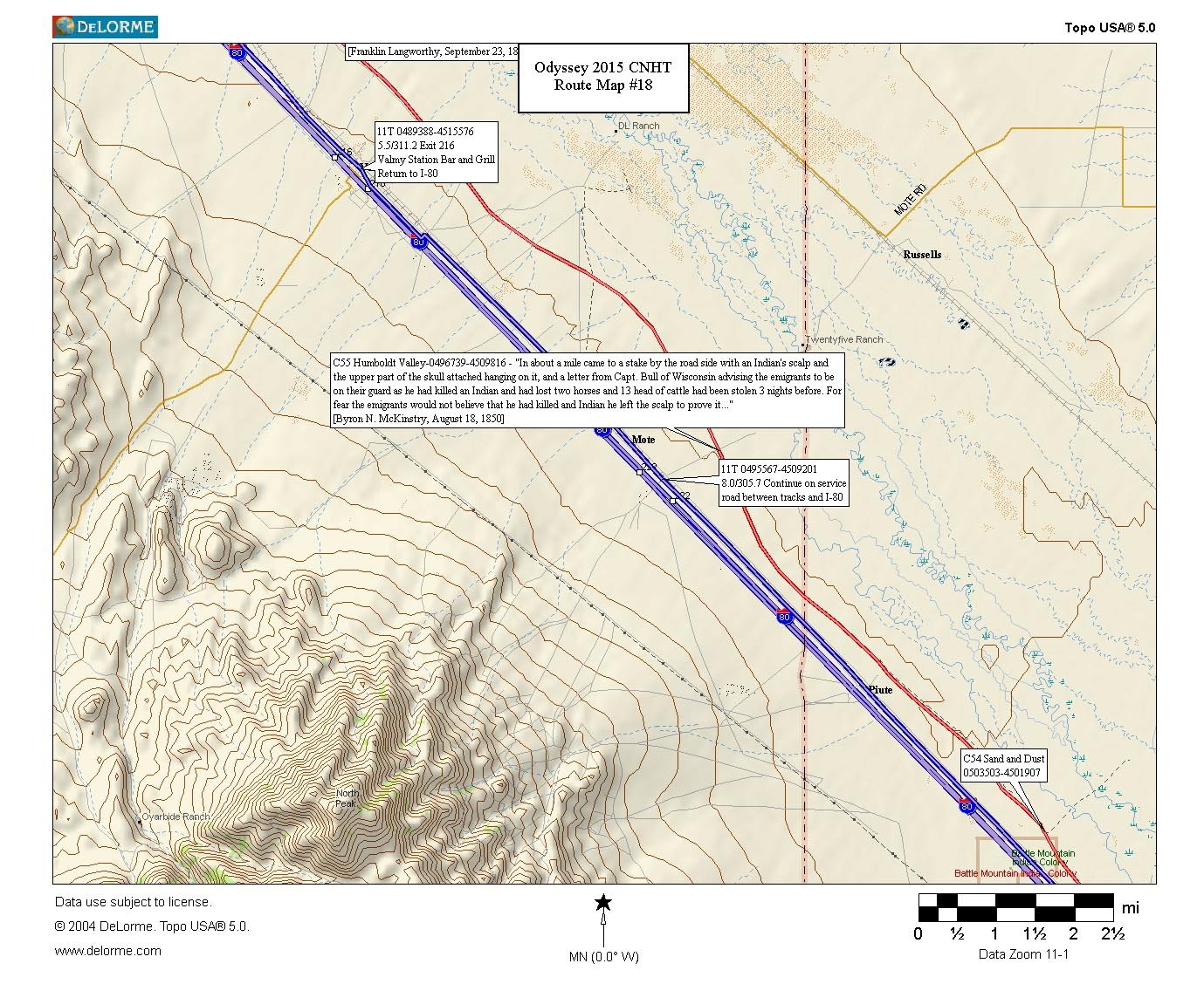
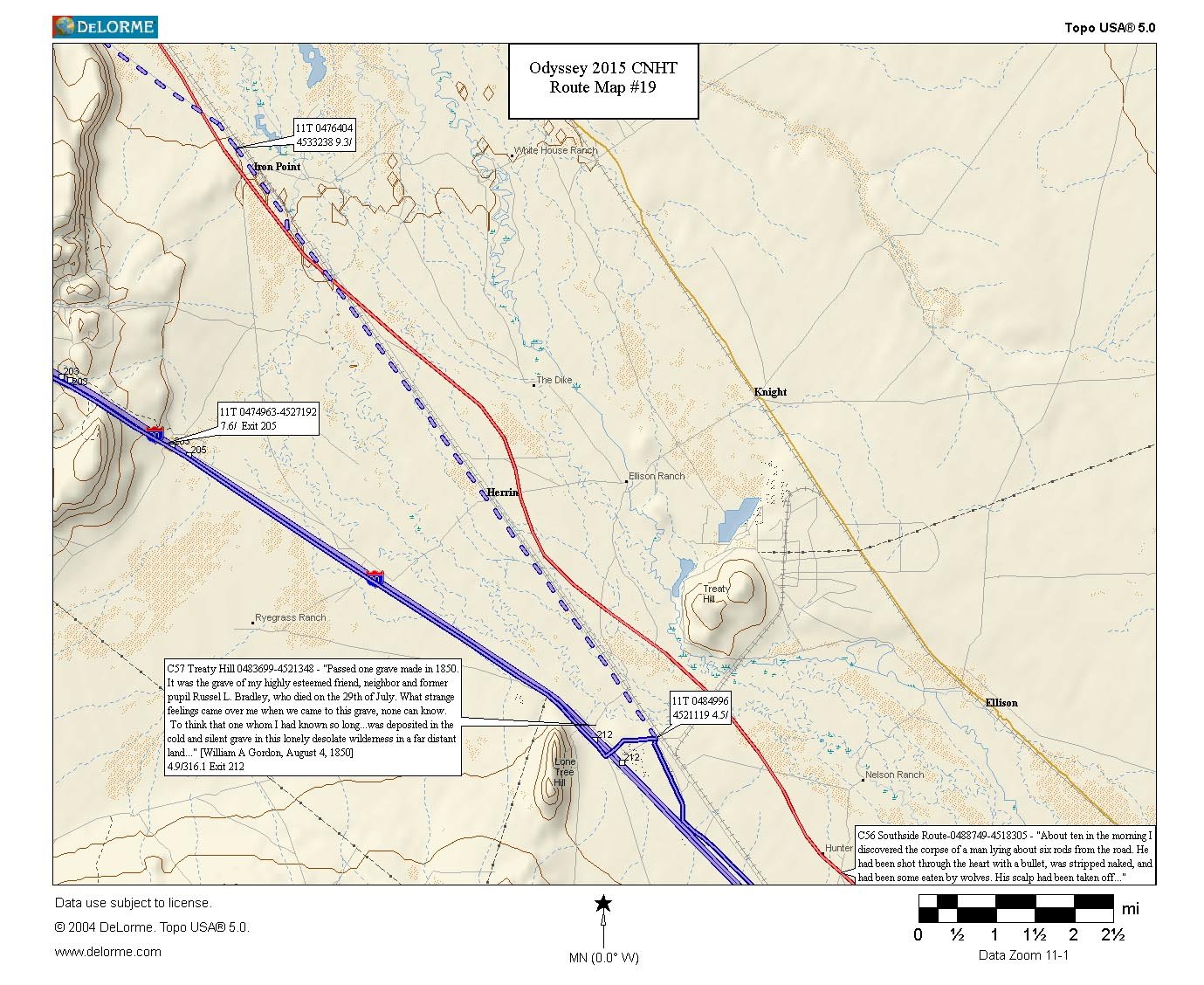
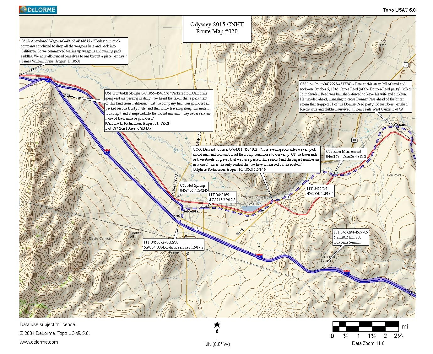
Map Notes:
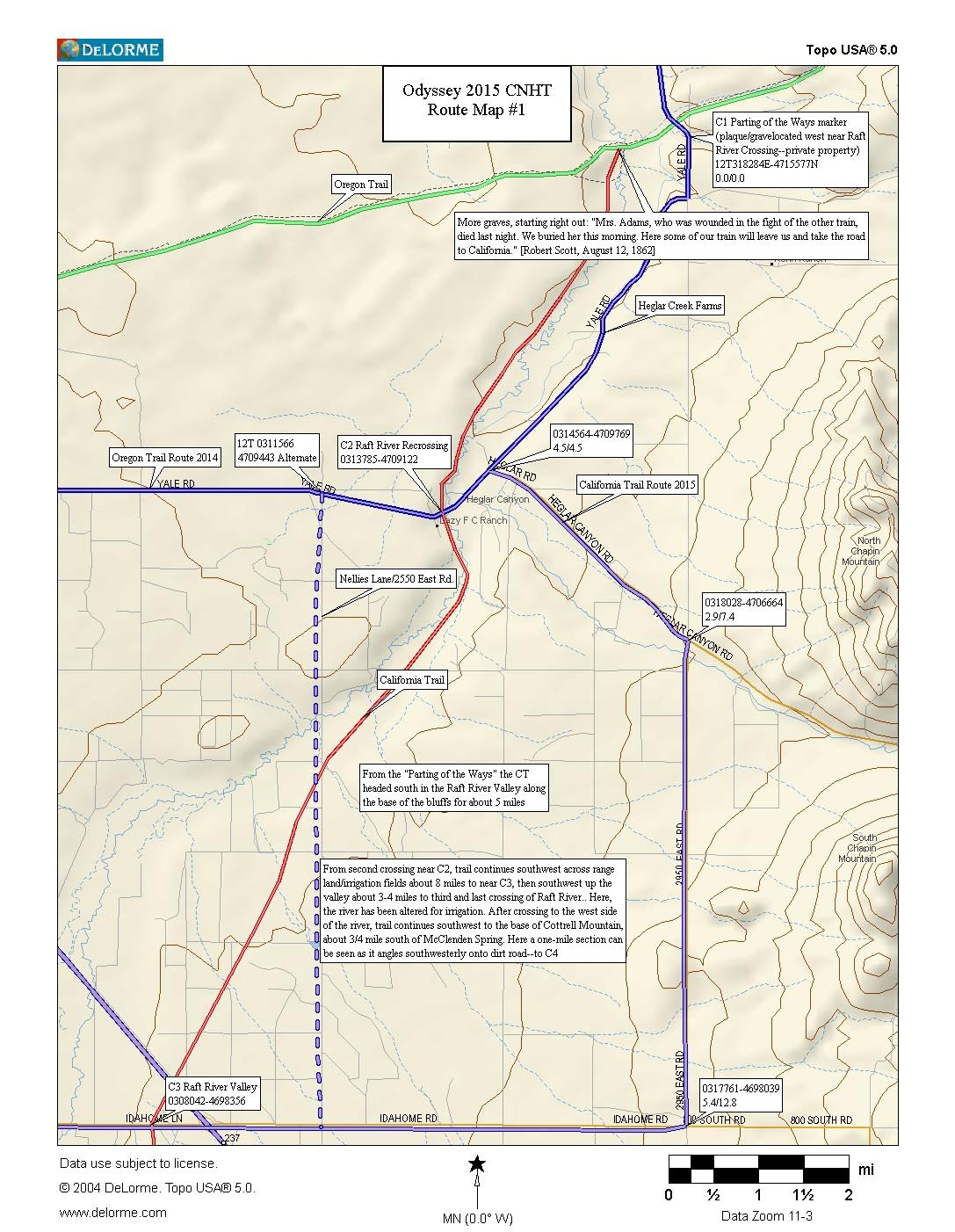
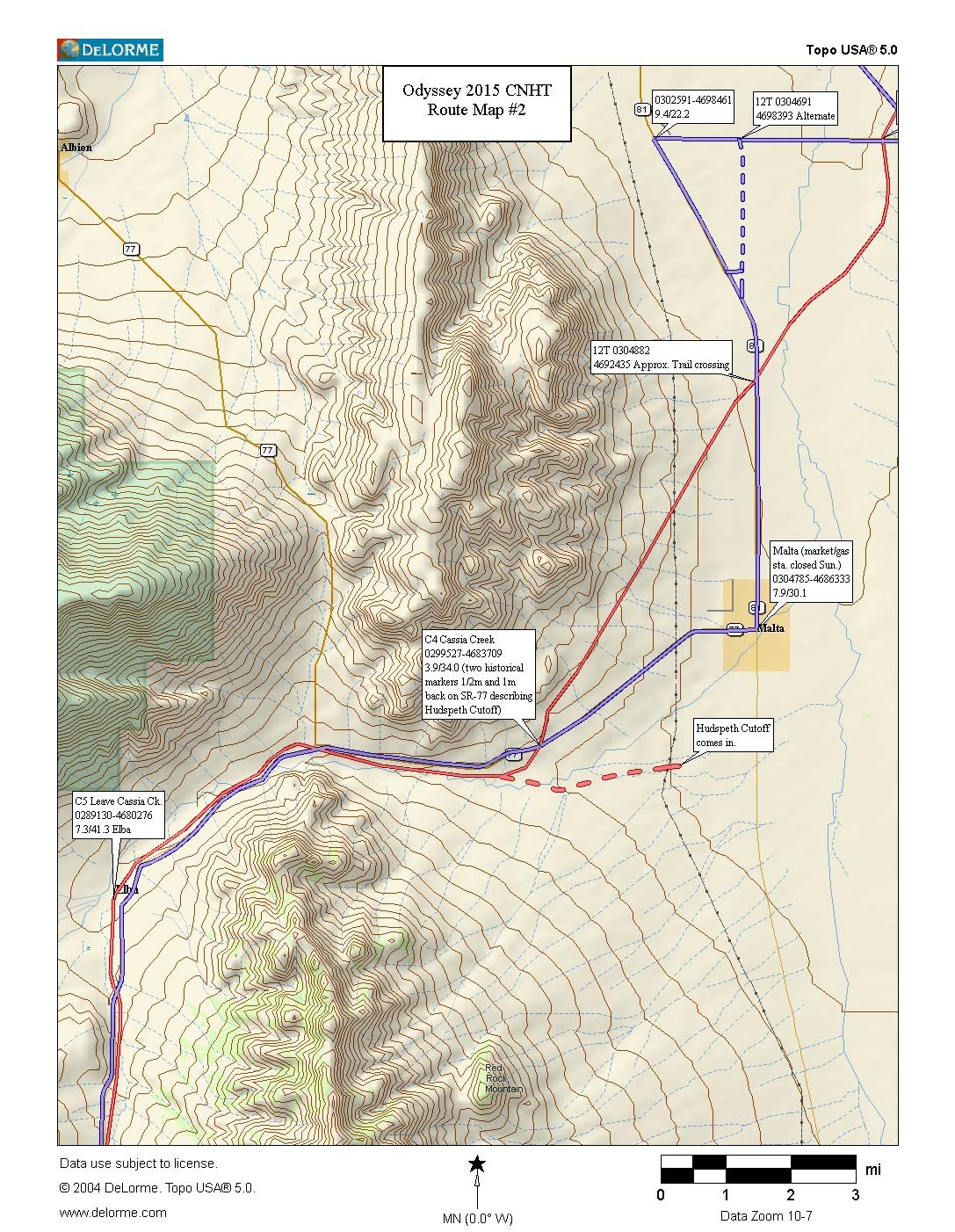
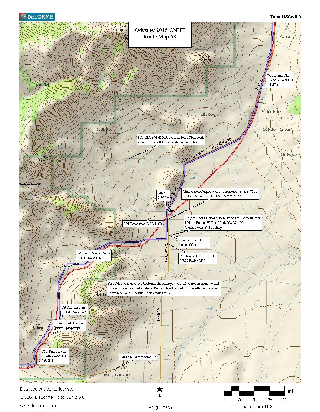
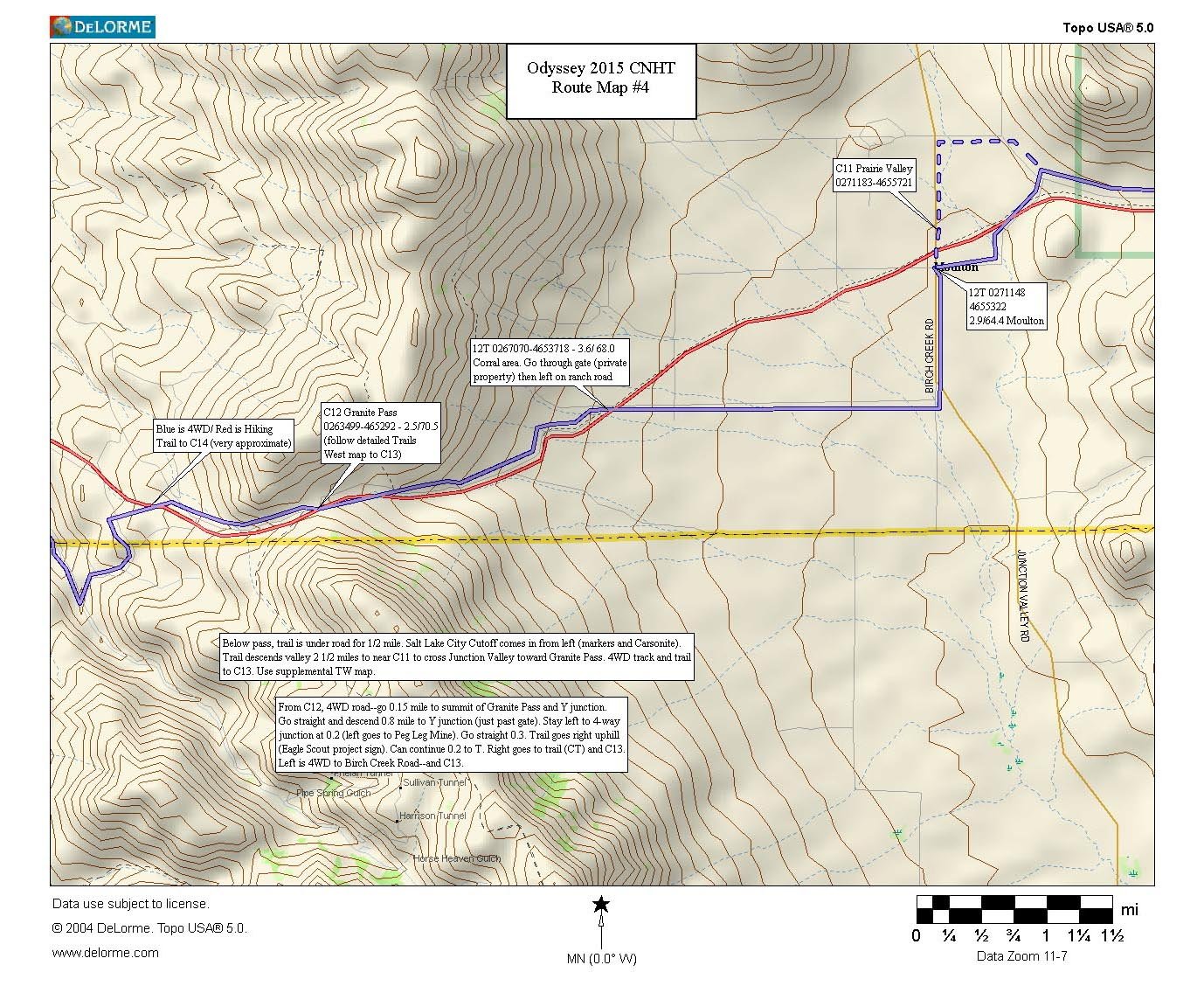
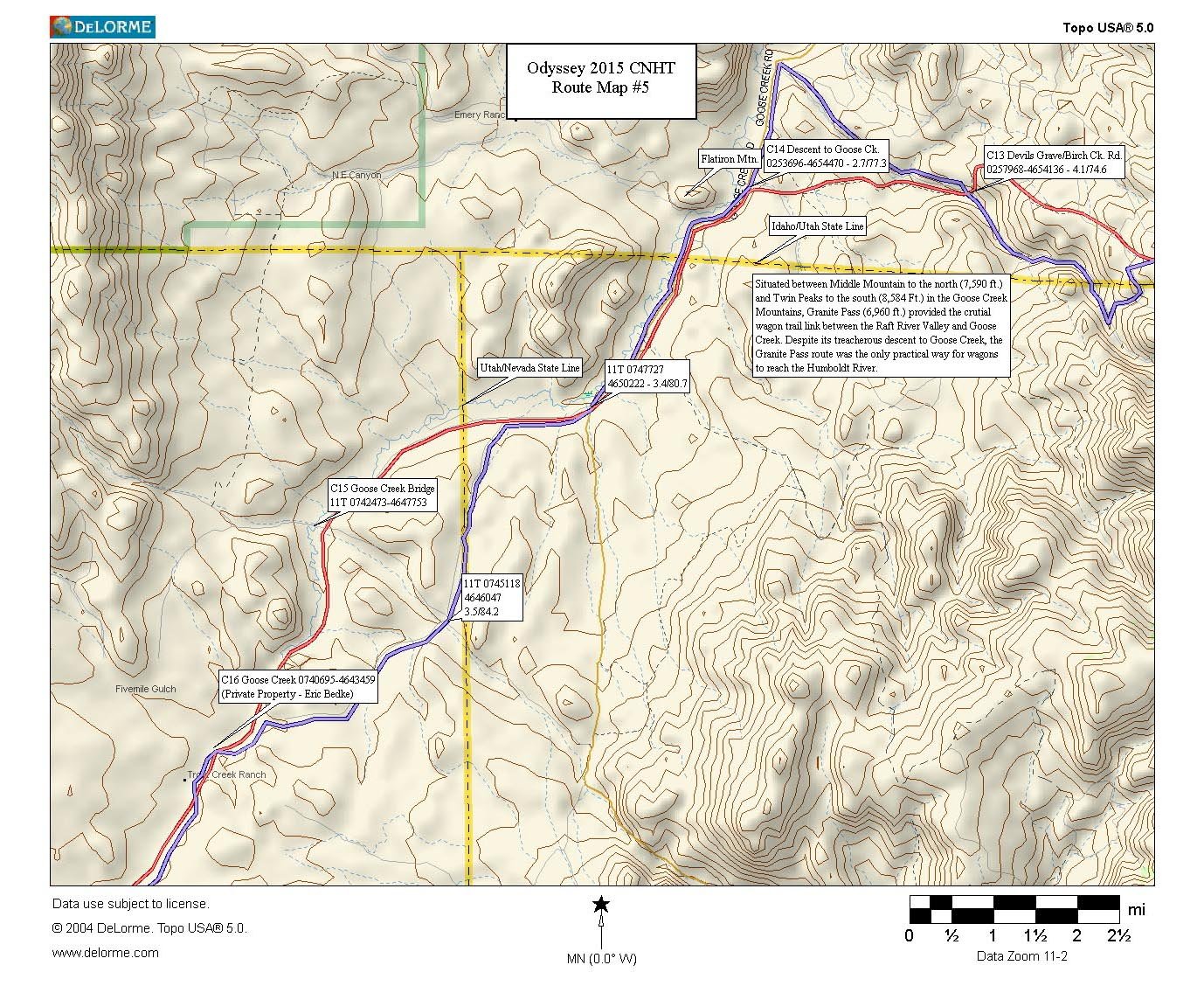
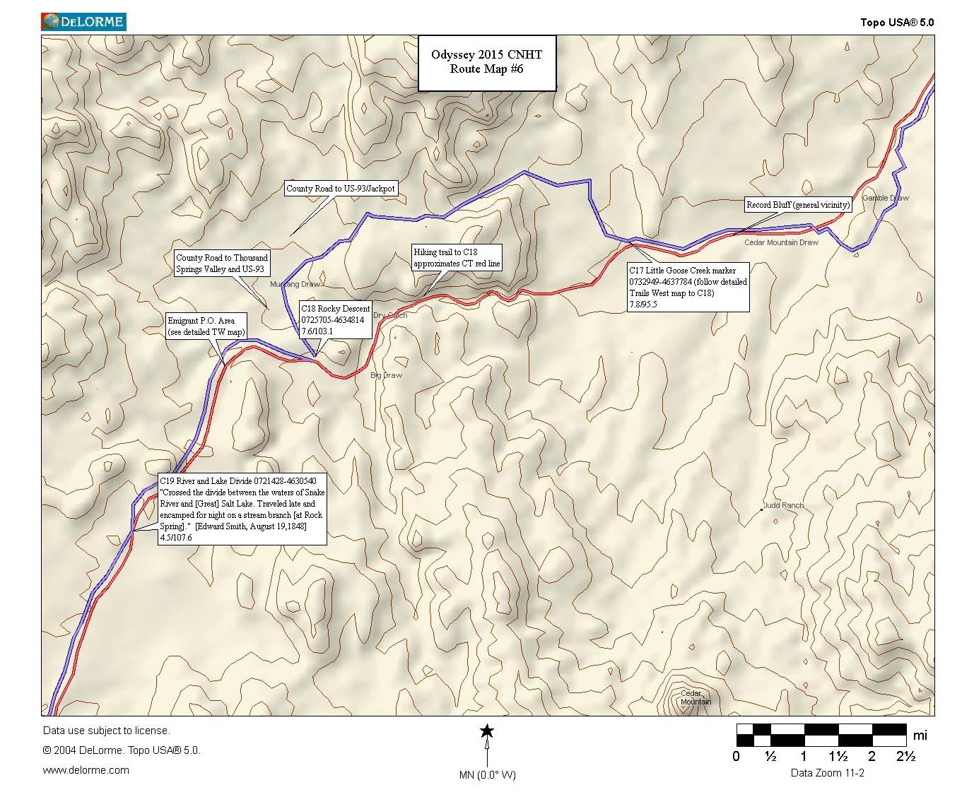
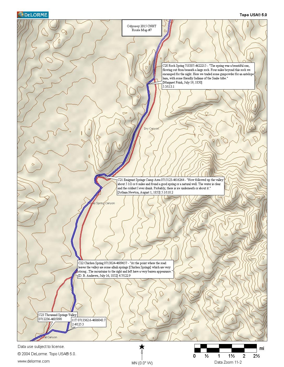
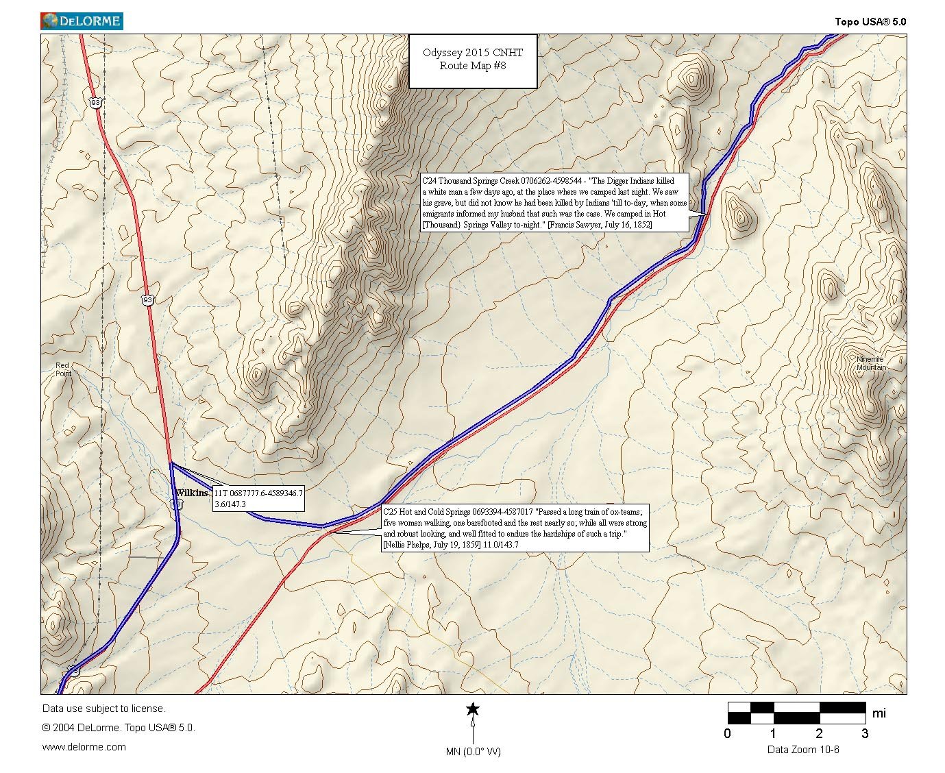
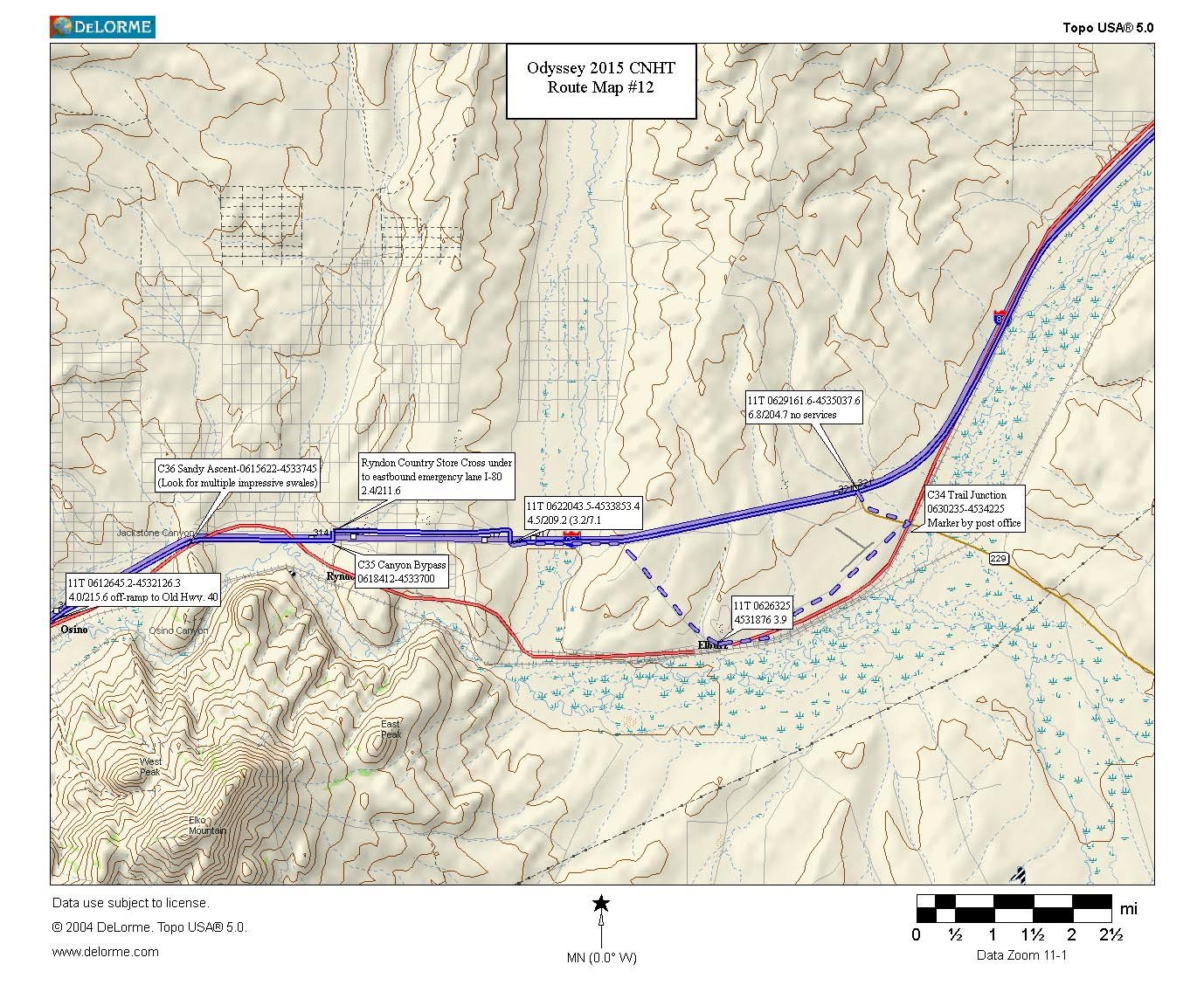
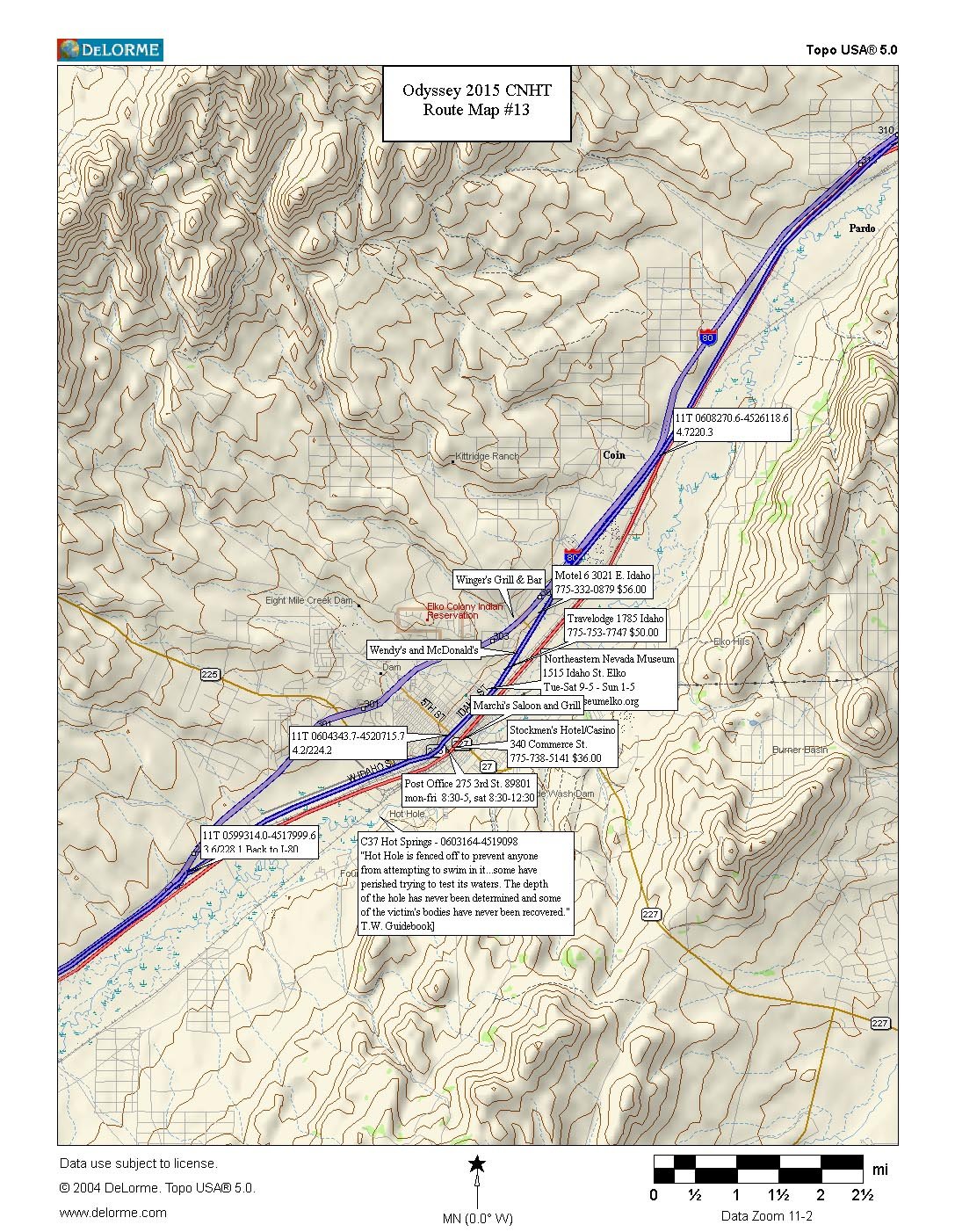
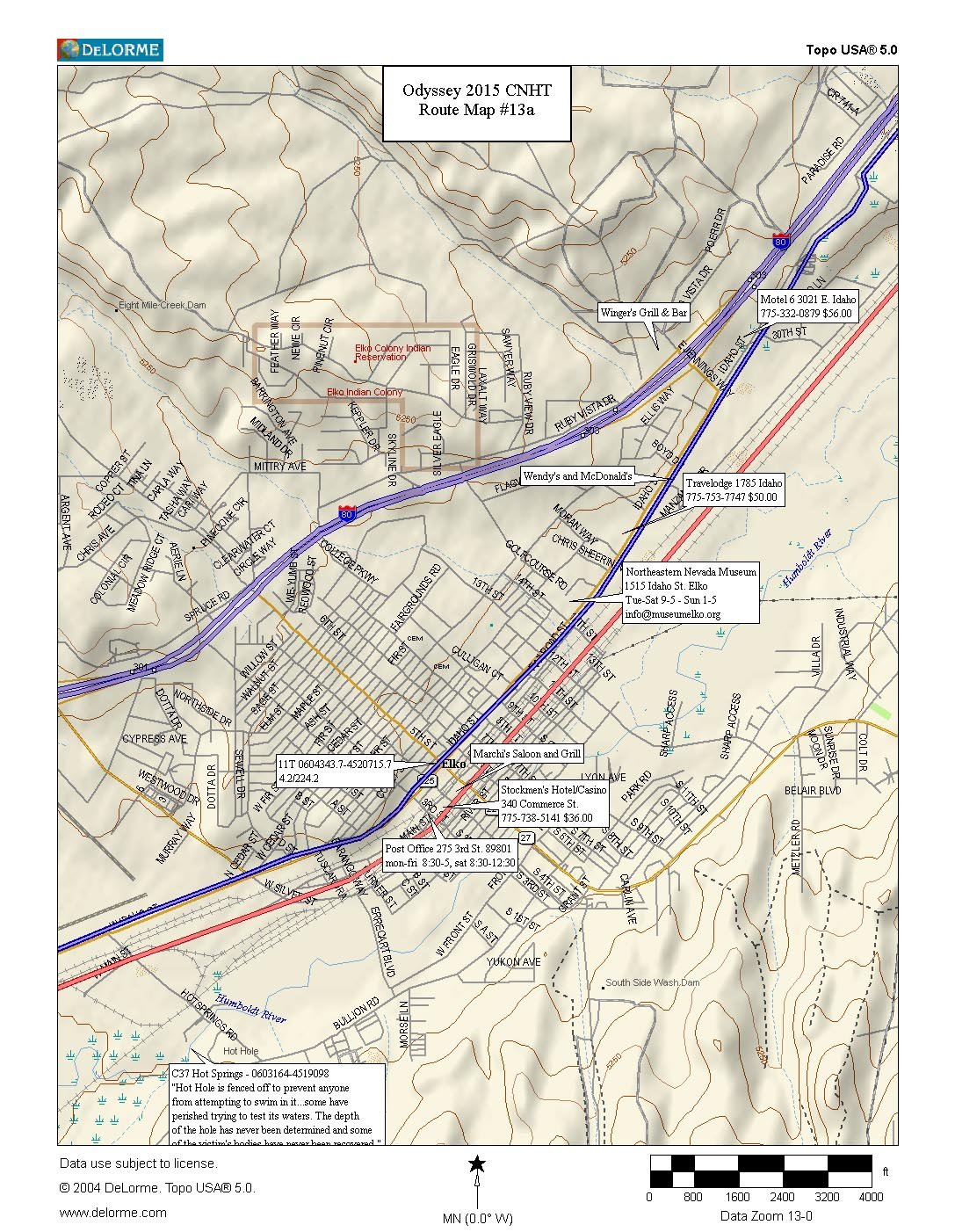
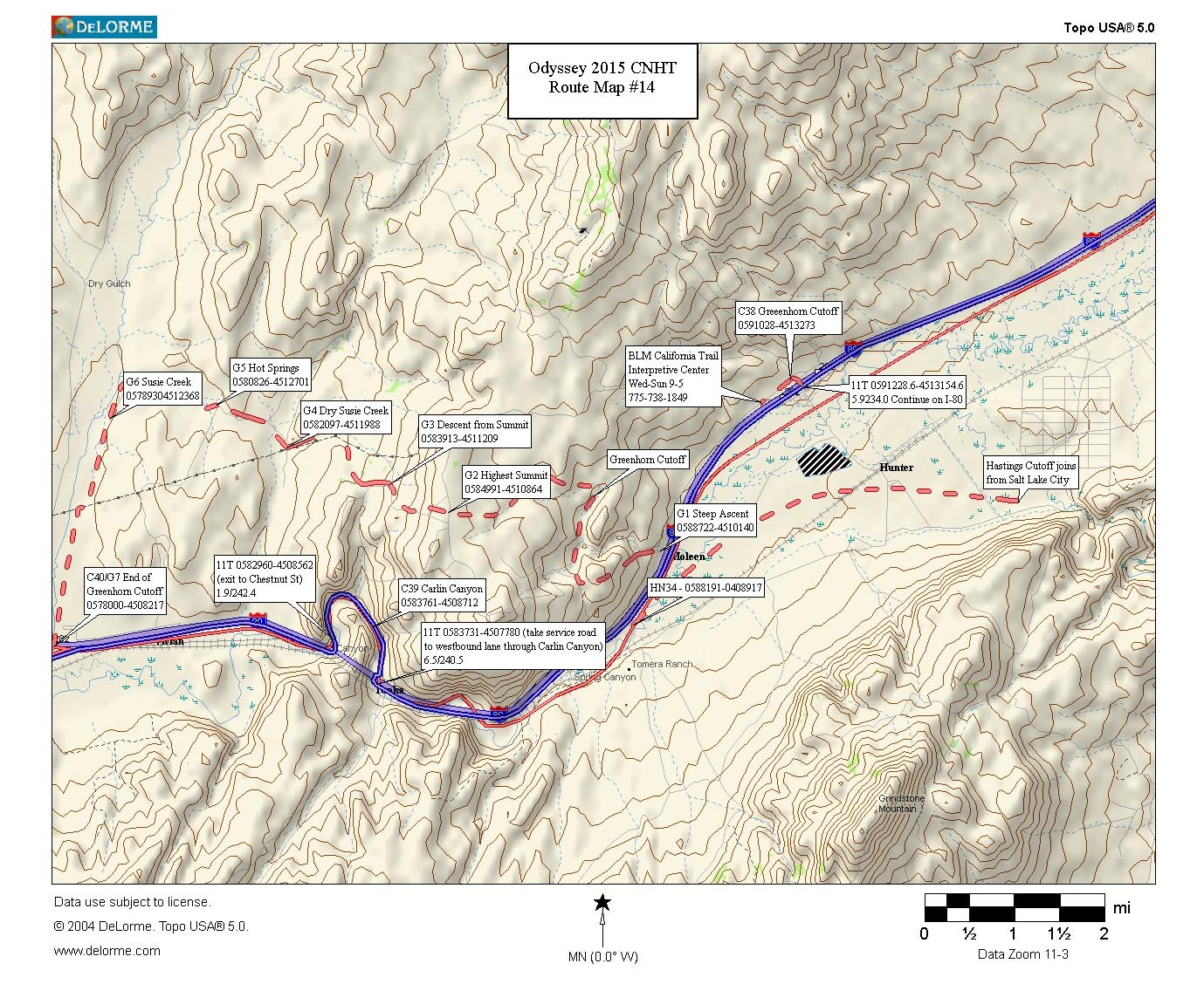
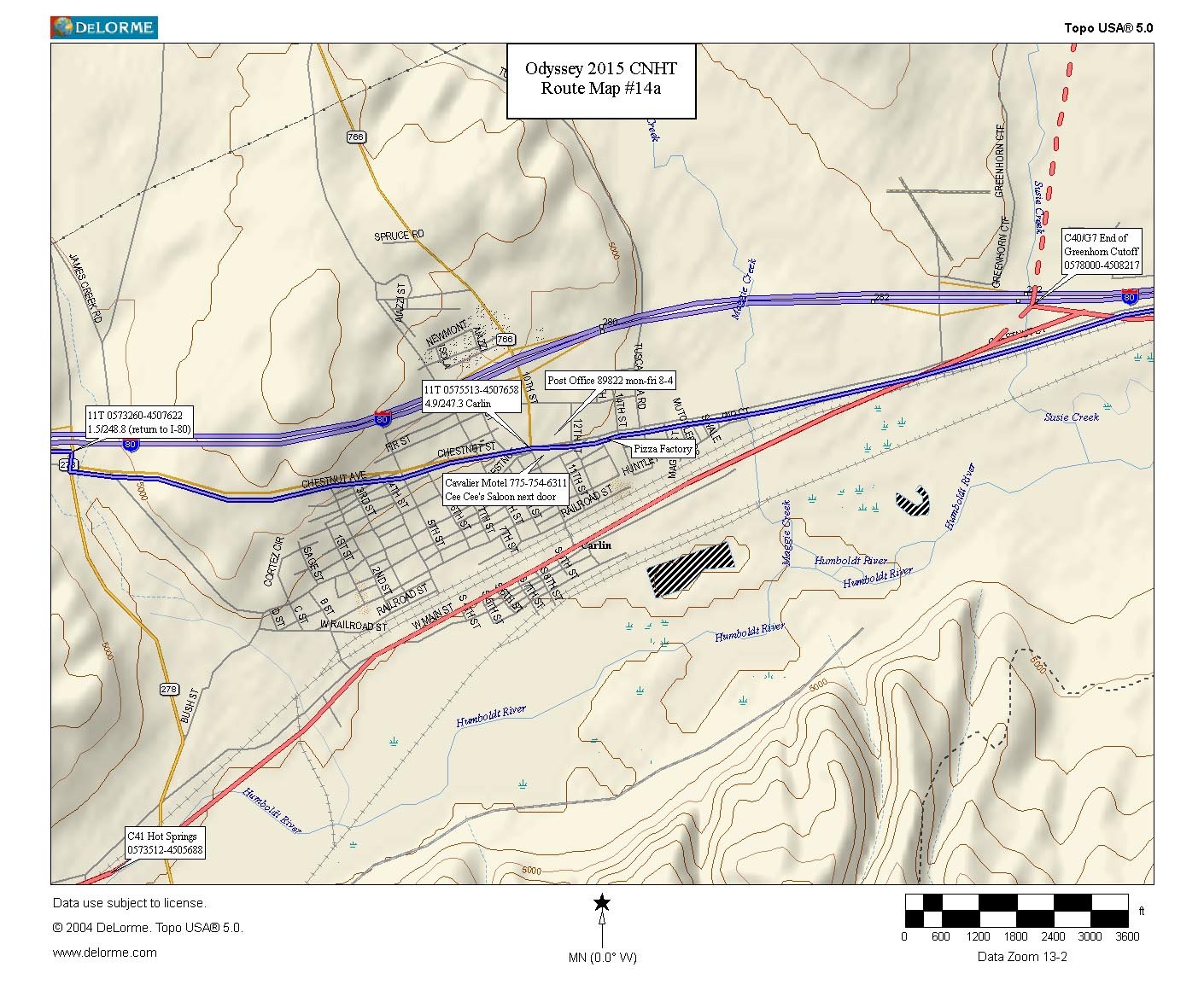
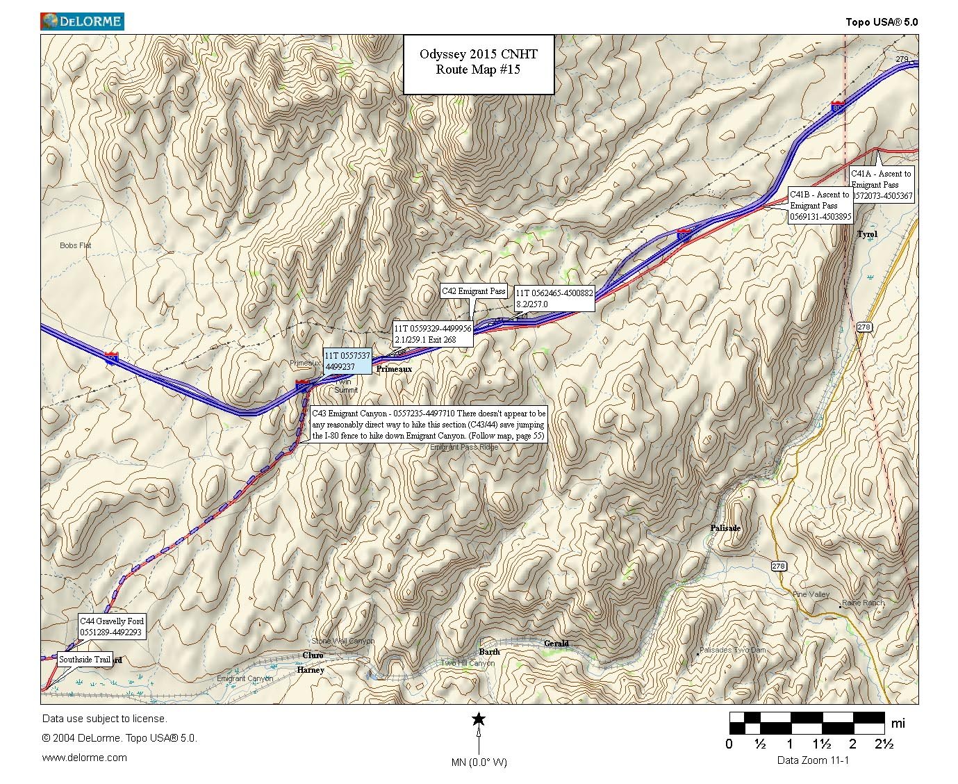
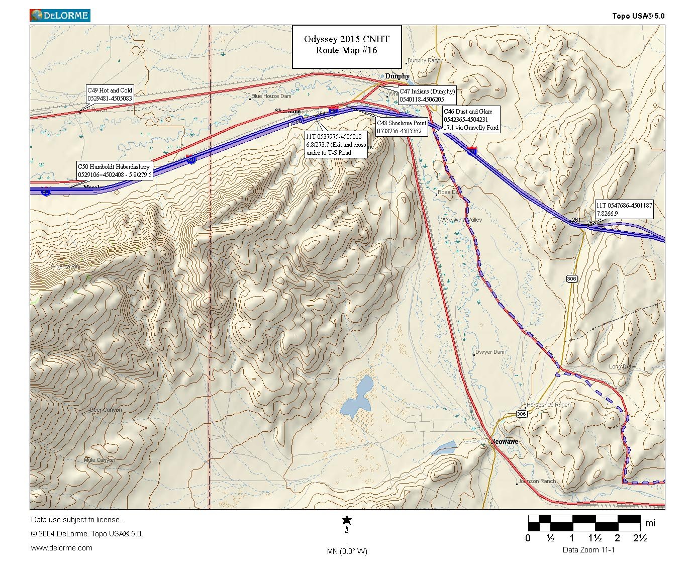
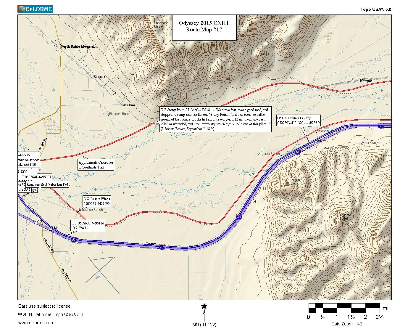
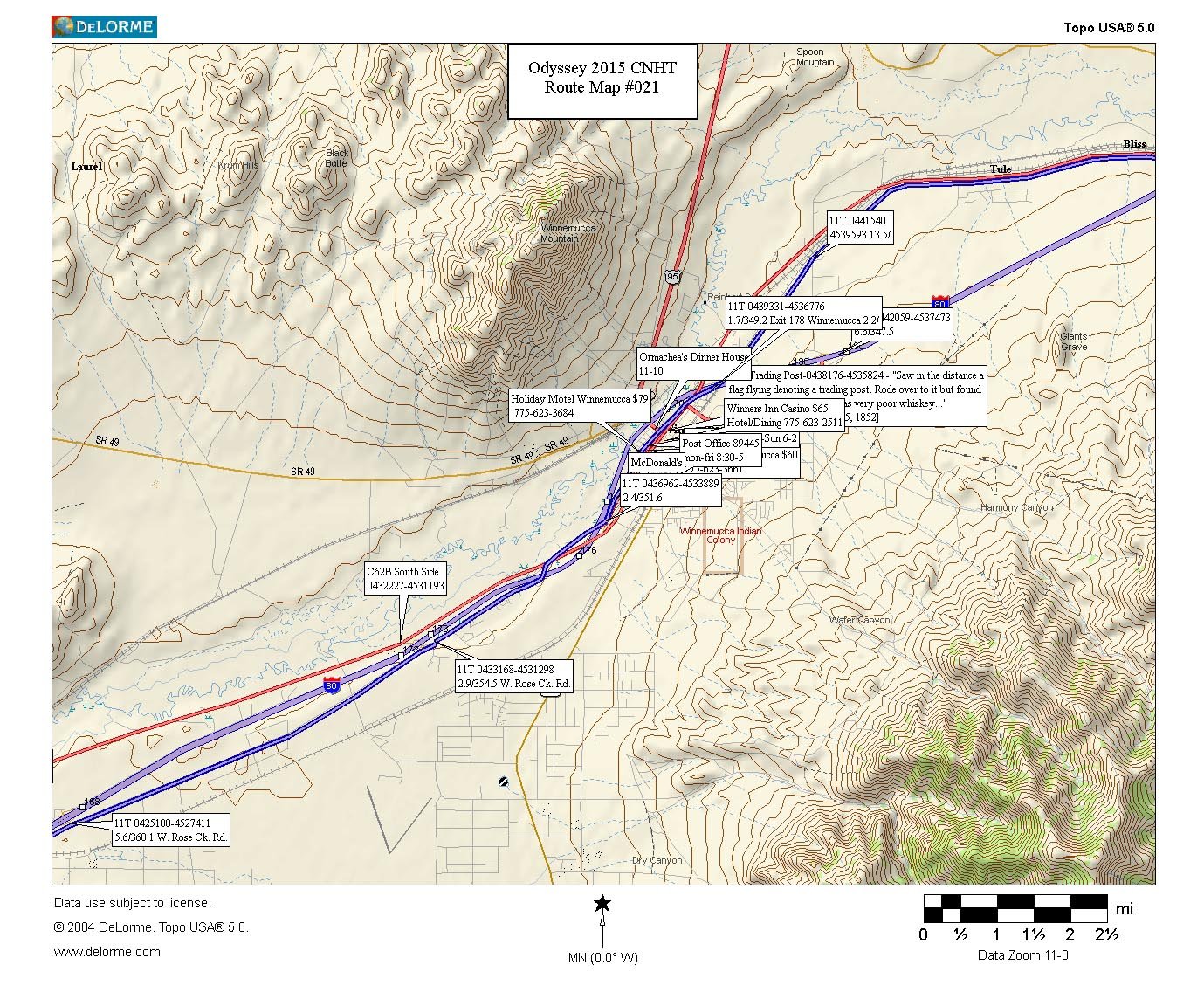
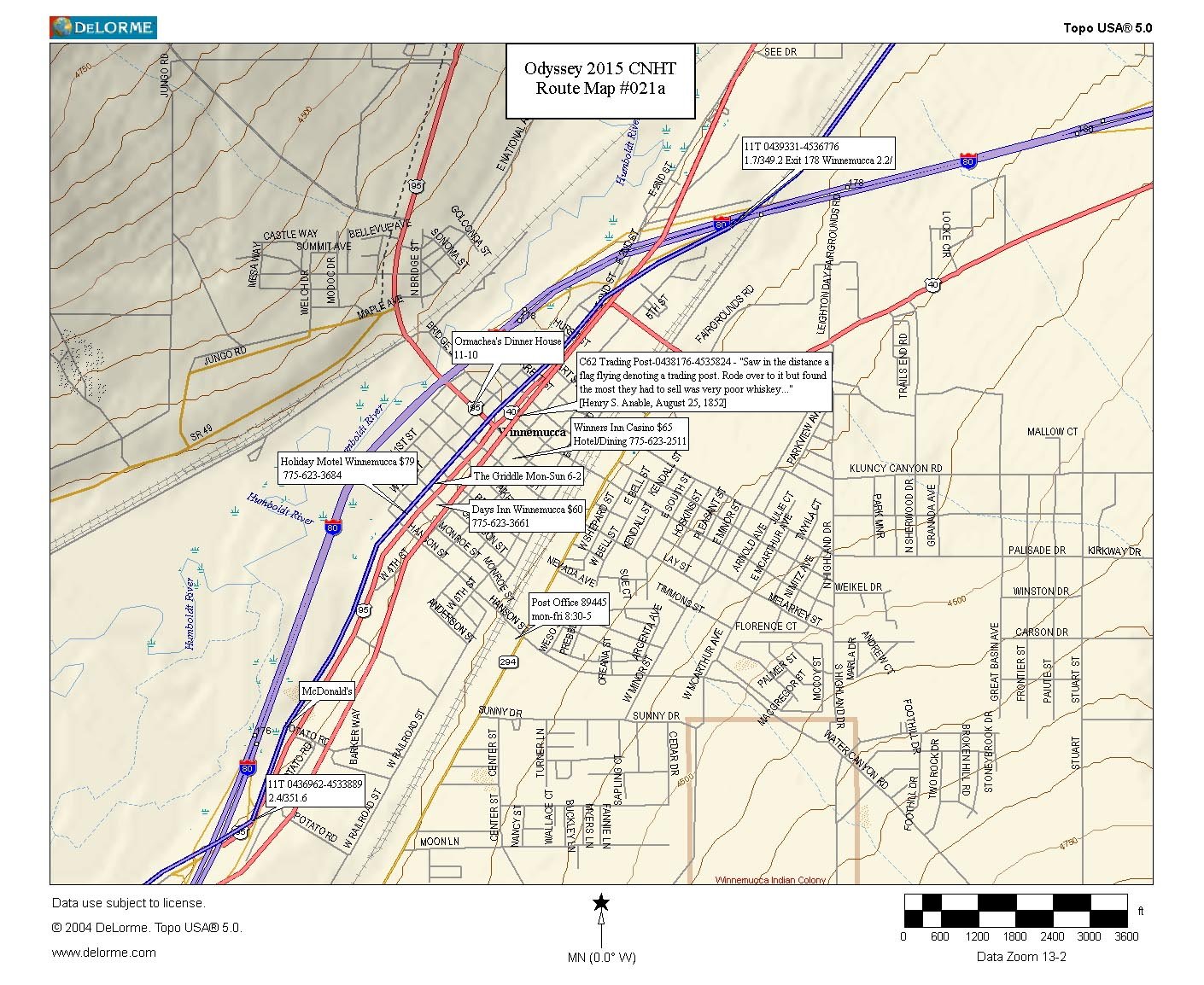
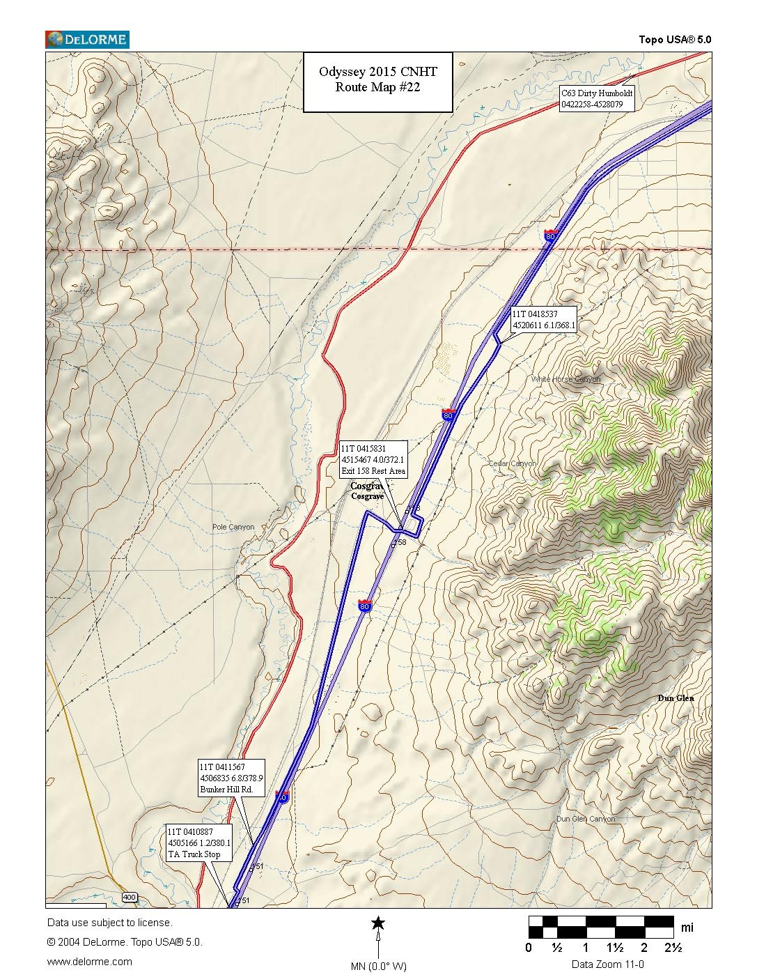
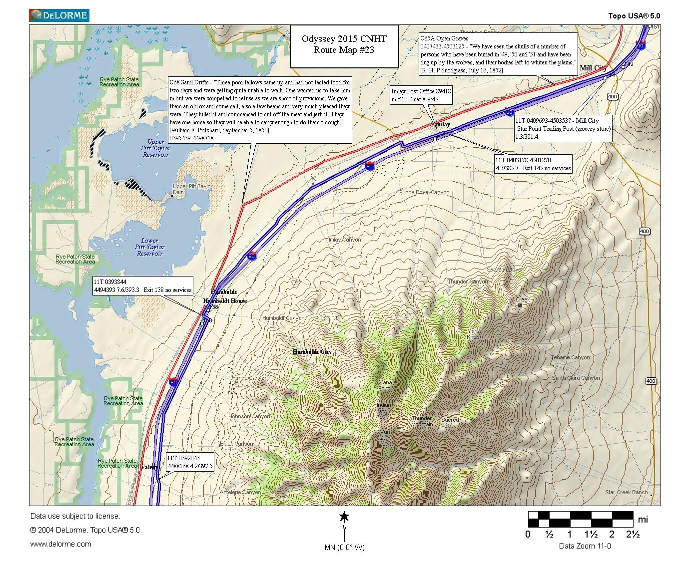
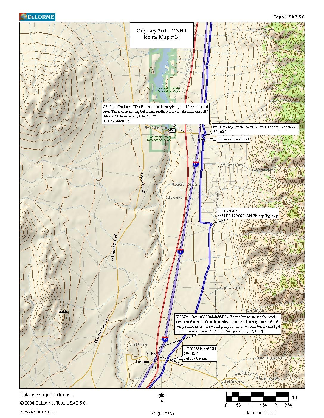
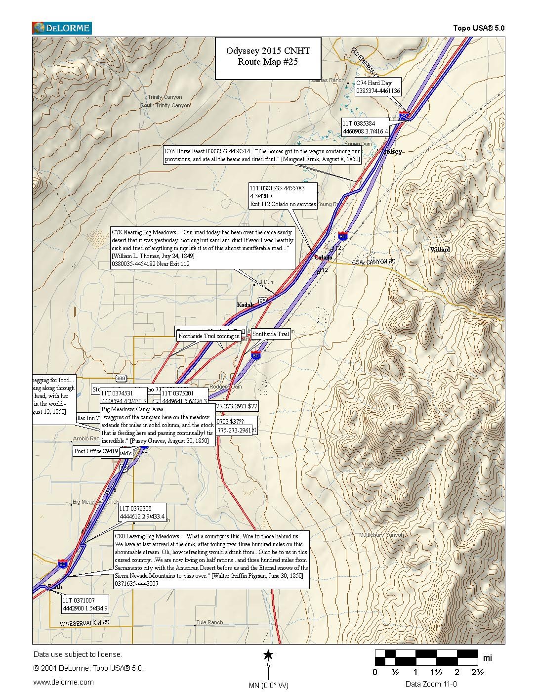
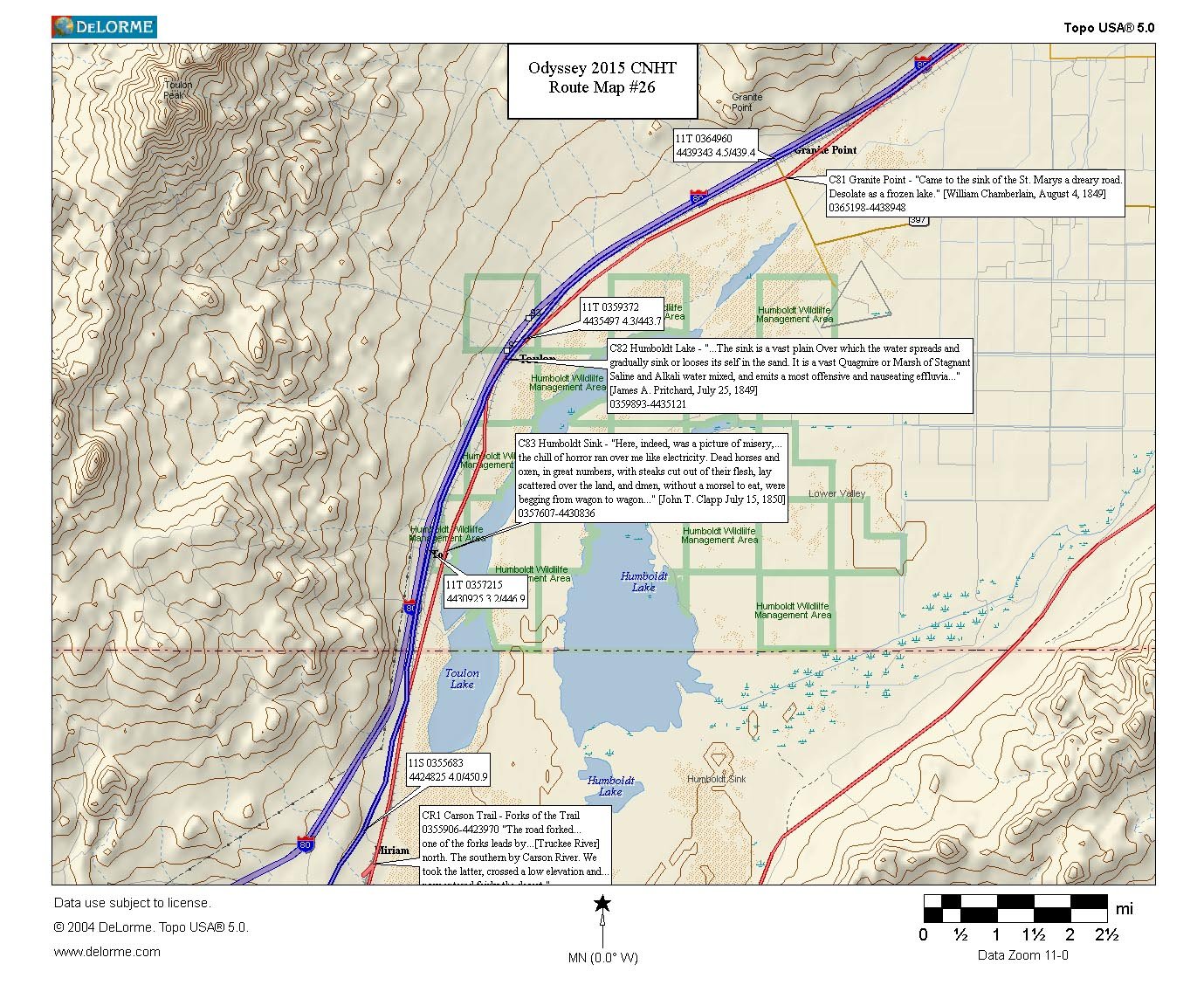
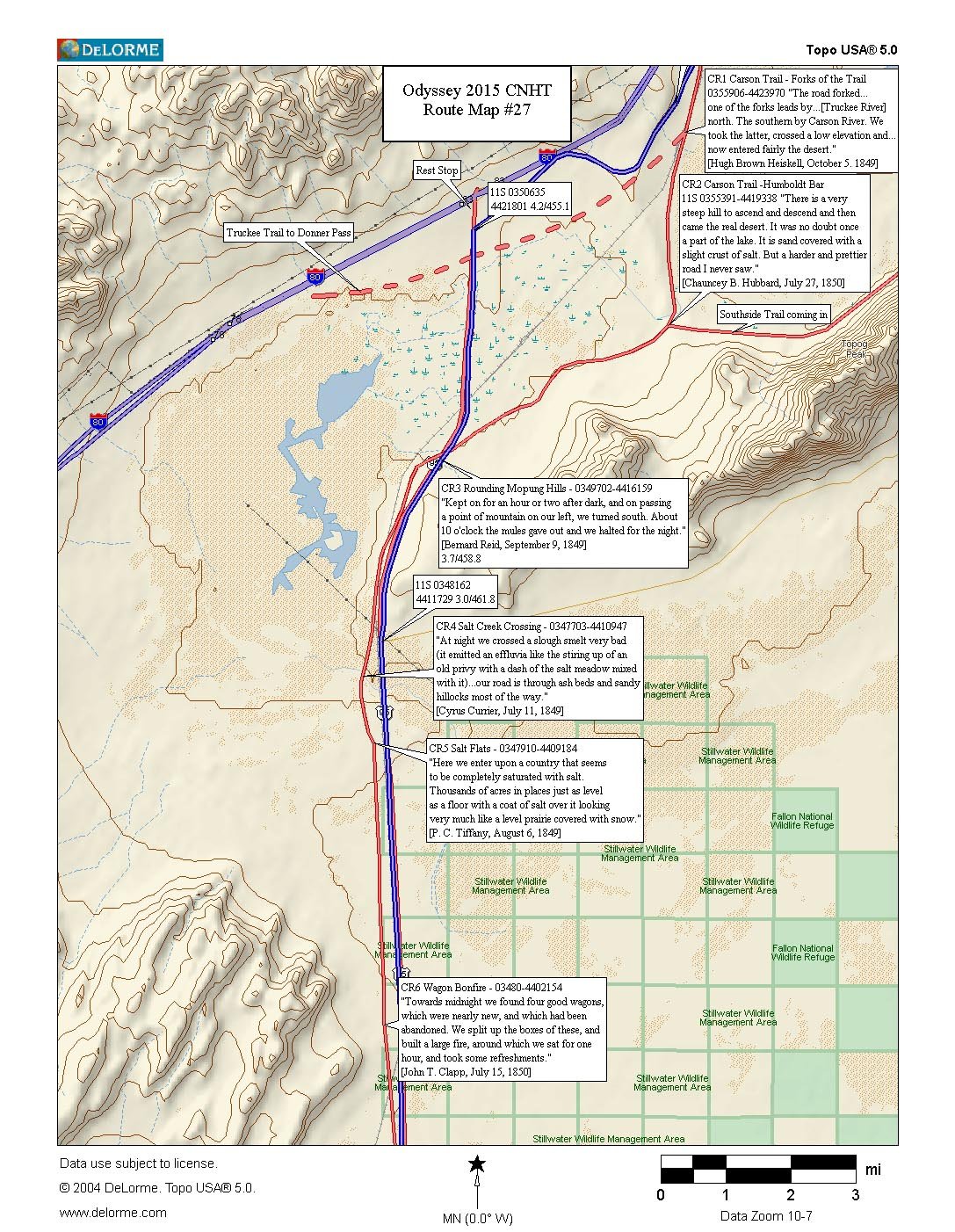
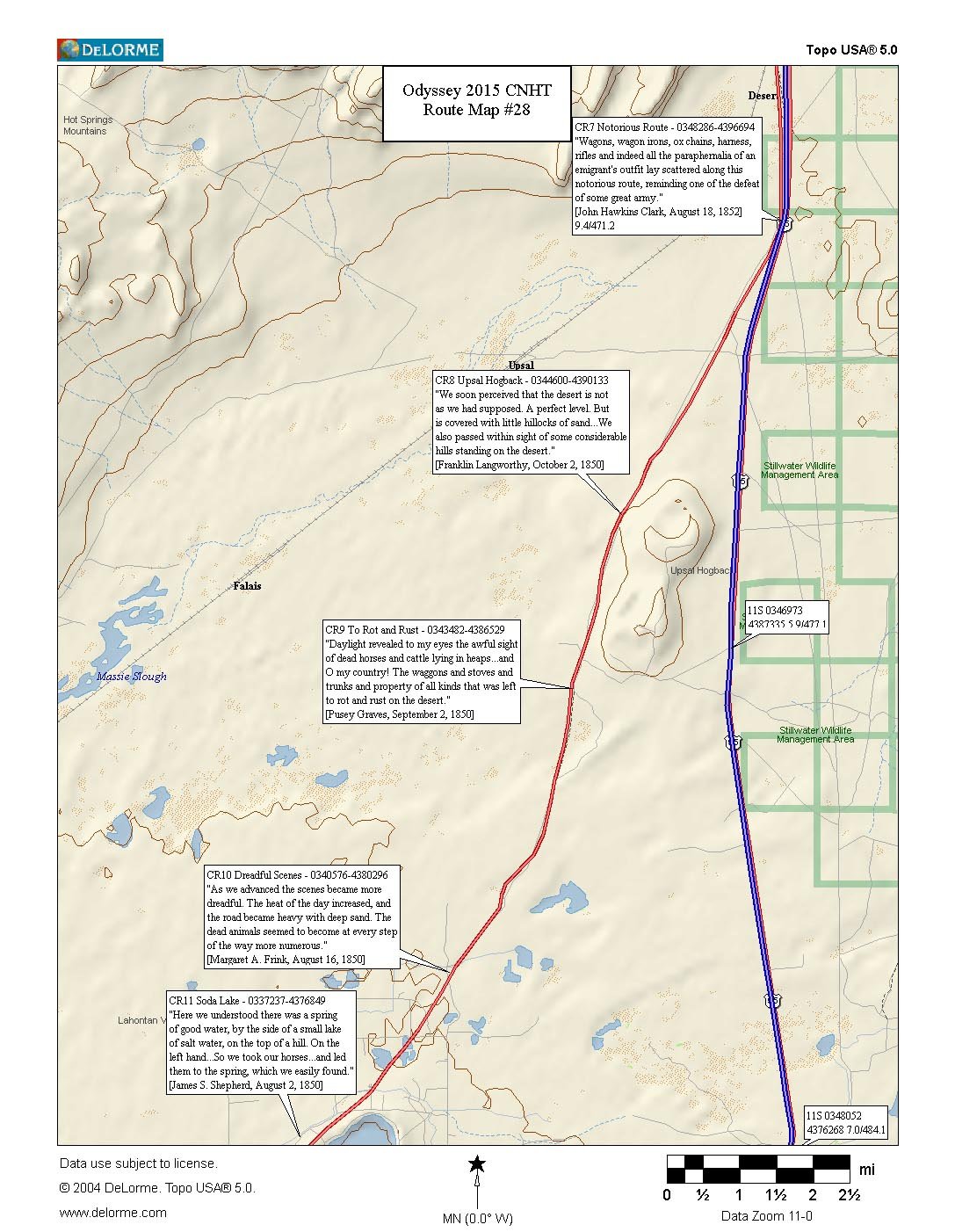
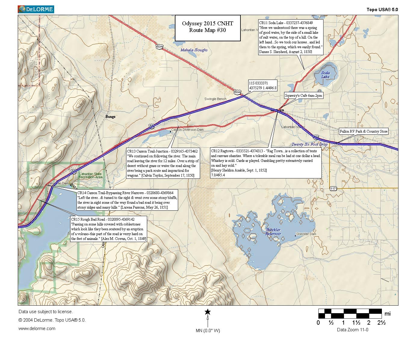
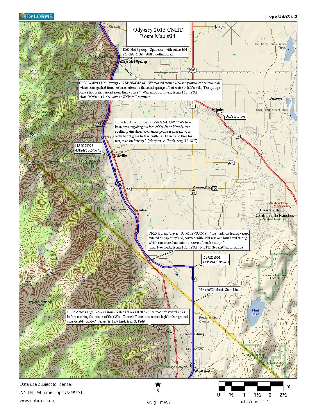
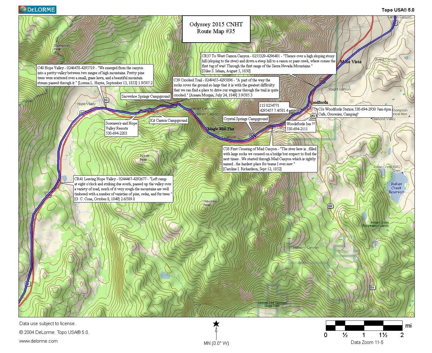
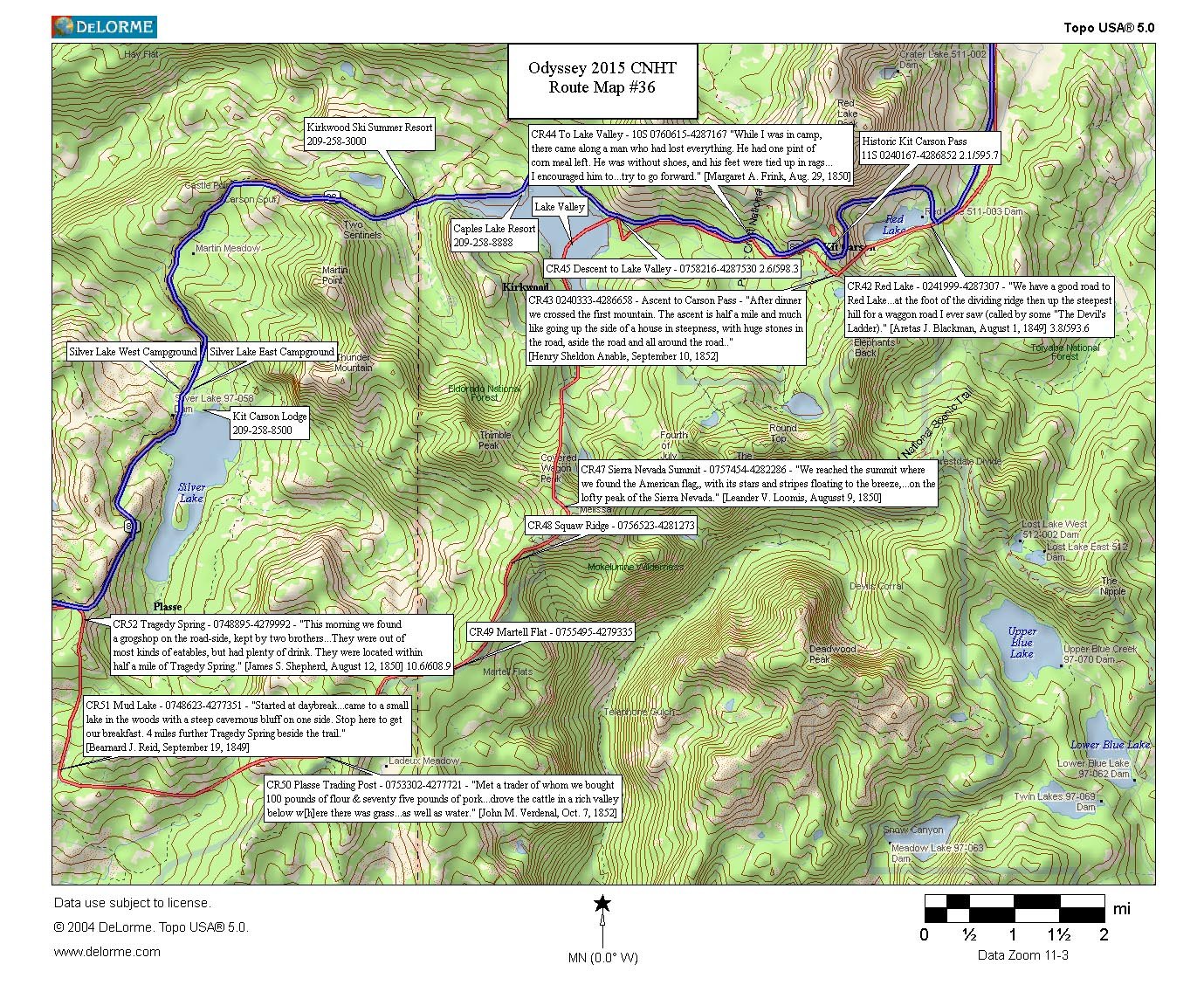
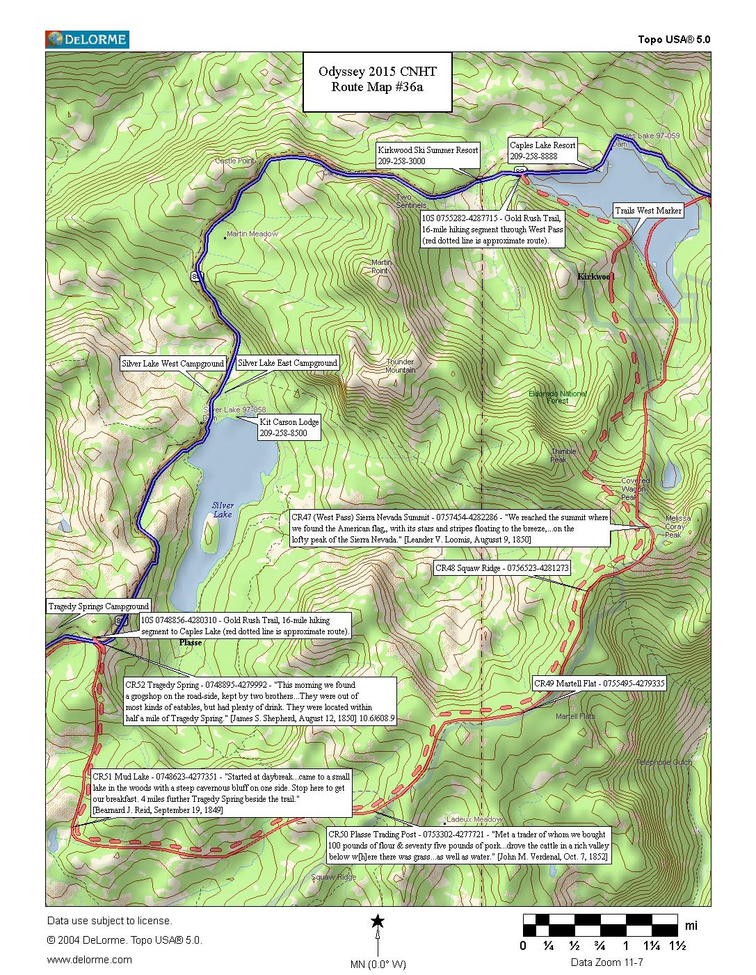
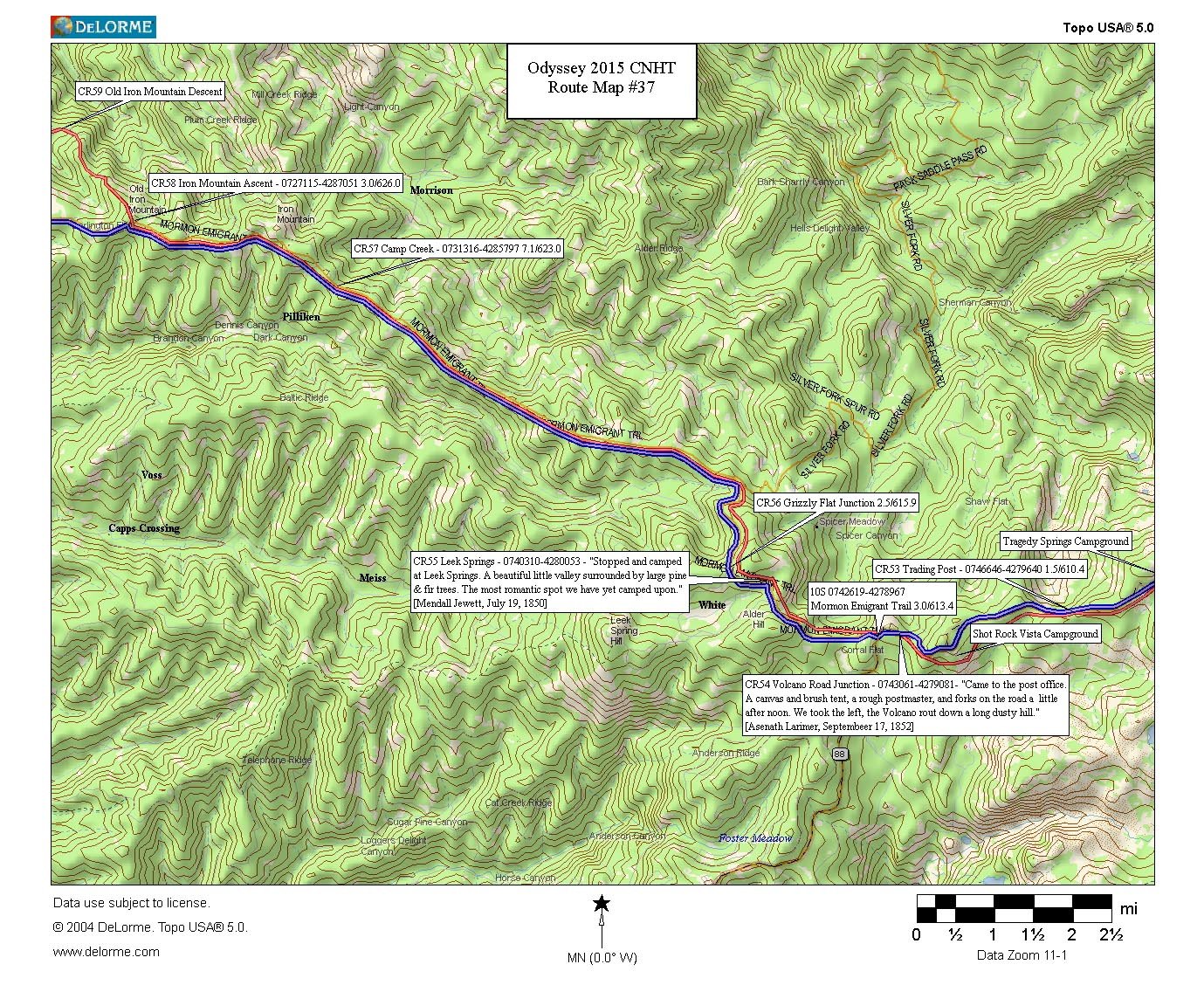
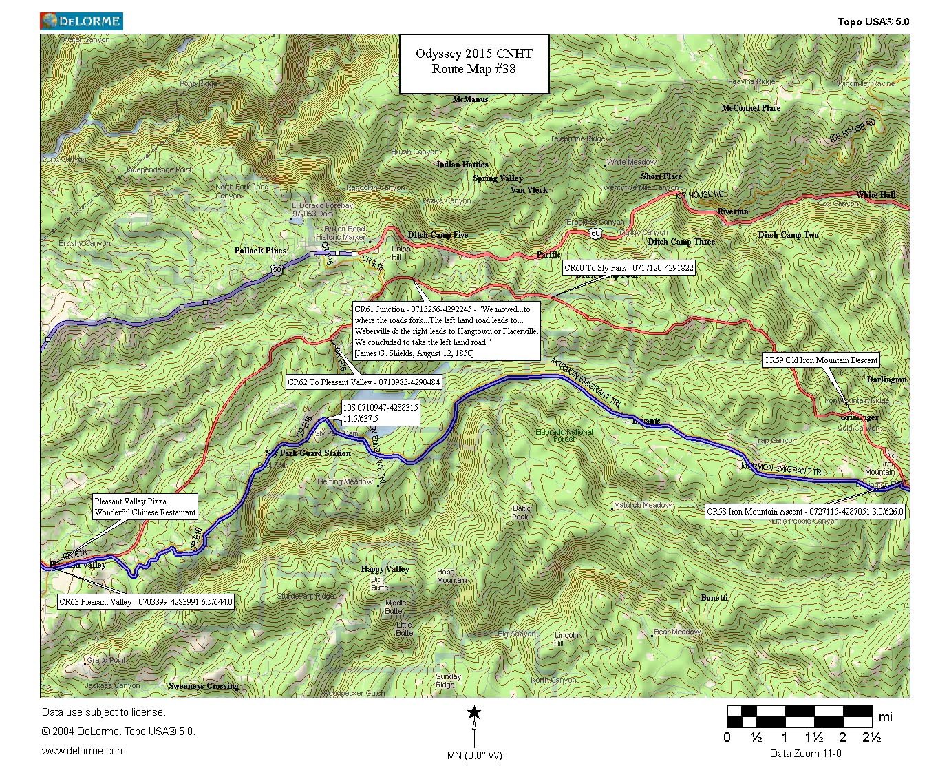
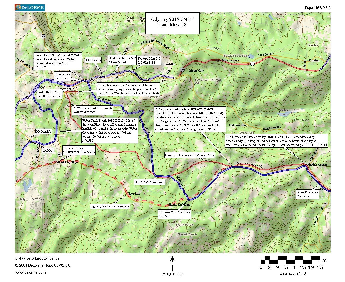
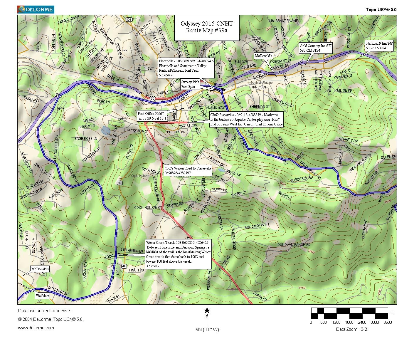
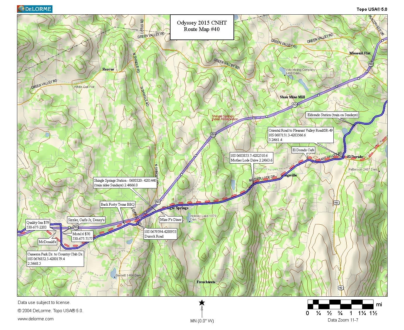
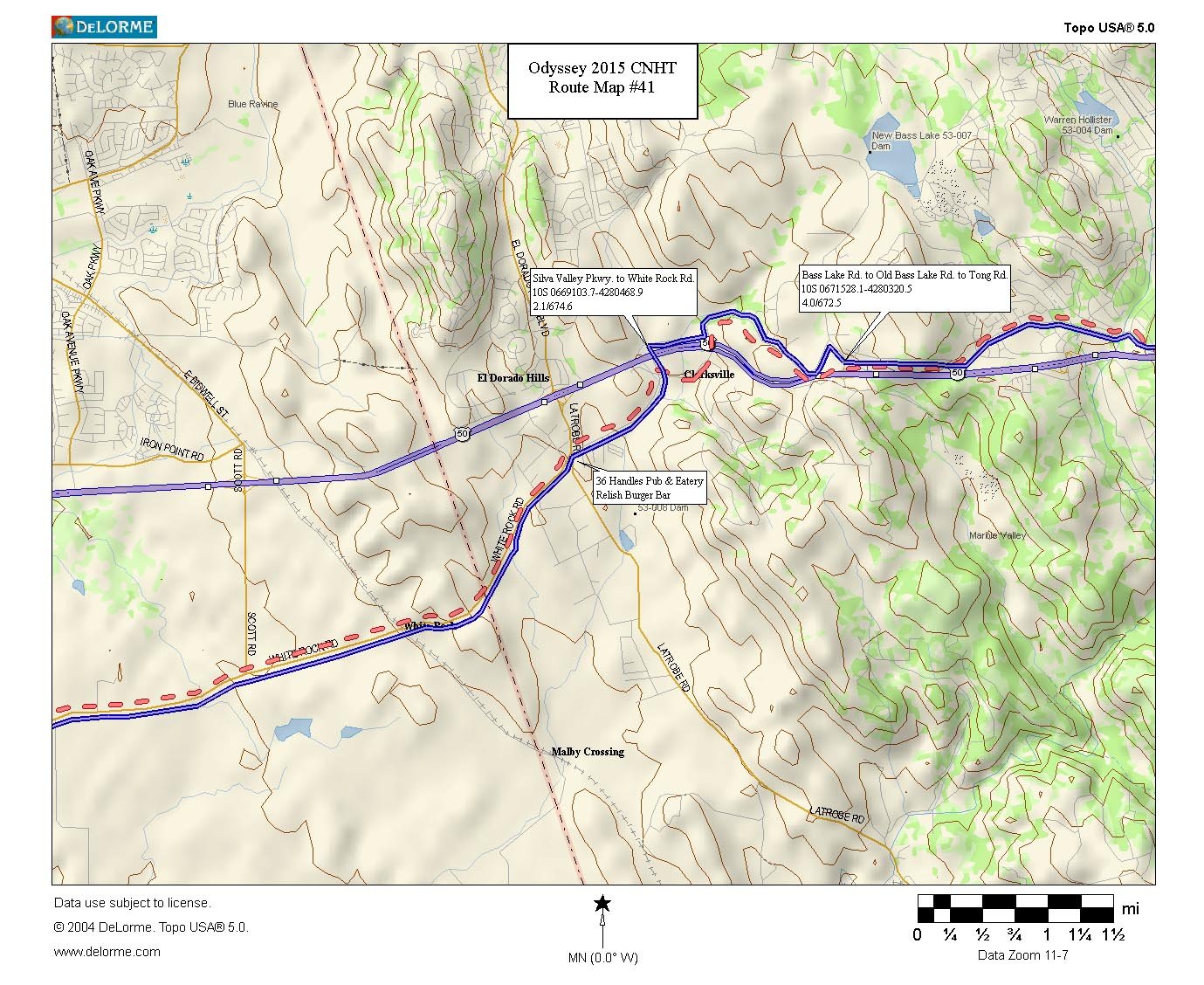
The solid green line on Map #001 denotes the Oregon Trail, the solid red line, the California Trail. The junction of these two trails, located on the hill above Raft River Crossing, is known as “Parting of the Ways.” Emigrants bound for Oregon followed the green-lined route, those headed for California, the red-lined one. A solid red line is used throughout to denote the approximate location of the California Trail (not to be confused with red-lined highways). Solid blue is used to denote Nimblewill’s trekking route (not to be confused with blue-lined interstate/limited access highways). Dotted lines denote alternate/other routes.
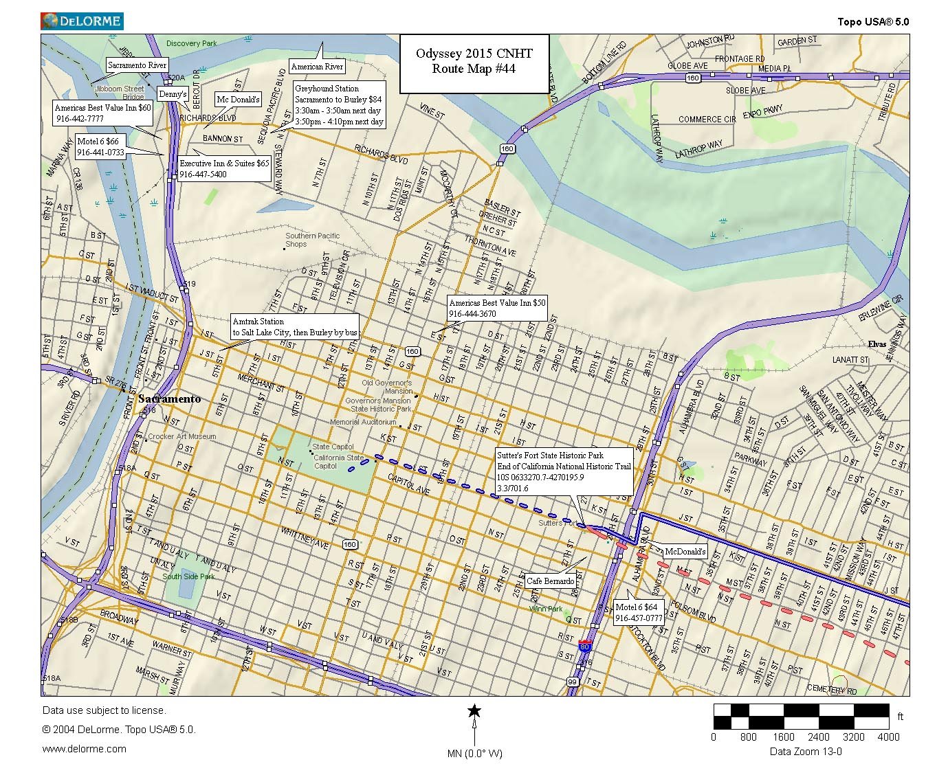
These California National Historic Trail maps were created using DeLorme Topo USA® Versions 5.0 and 8.0 software, through licensed agreement with DeLorme–for non-commercial purposes.
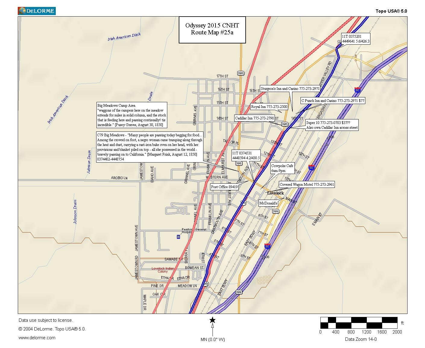
Mapnotes C1-C83 and CR1-CR69 denote fixed California Trail markers, which have been placed all along the trail by Trails West, Inc. volunteers. Much of the material appearing in these maps–narrative, emigrant quotes, and other historical information–comes directly from Trails West, Inc. guidebooks, and has been used here with their kind permission.
Odyssey Begins at Raft River Crossing, Idaho (Parting of the Ways)
Idaho / Utah / Nevada /California Maps
Beyond