Sponsors Journals Itinerary Gear List
Sunday–April 25, 2021
Trail Day–065
Trail Mile–14.6/682.0
Location–Max Patch Summit, AT Mile 255.1

 Even though it’s Sunday, Julie from Gatlinburg Nantahala Outdoor Center has offered to shuttle us (again), this time, back to Davenport Gap. The Waffle House is right next the motel, so we meet there. Great company for breakfast!
A fair run up the interstate back to Davenport Gap, but Julie has us here, packs on and hiking a bit after seven. Thanks, Julie (now my dear friend)–what a great service you provide!
 We’re faced first thing with a tough 2,500-foot climb up and over Snowbird Peak. A short bail-off to Groundhog Creek Shelter, then another long, steady climb to Max Patch.
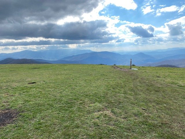
I’ve been looking forward to this day with great anticipation. For today I’ll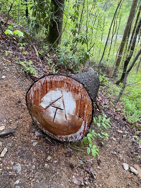 complete another climb (my fourth) to the grand bald that is Max Patch. My first climb up was back in 1983 during a section hike. In fact, I was the first hiker to climb Max Patch. It’s a fascinating story. In fact I even wrote an article about that day–which was later published in the Appalachian Trailway News. I include it here, a bit of trail history. I pray your indulgence and hope you enjoy…


Thursday—May 7, 1998
Trail Day—111/17
Trial Mile—1653/252
Location—Max Patch Summit

Fifteen years ago [38 years ago now] on a rainy summer day, and as fate would have it, I became the first backpacker coming through from Springer Mountain to stand in total awe on the summit of Max Patch. The excitement of that memorable day was recorded in an article published in the Appalachian Trailway News, March/April 1986 issue.


Returning again to this magnificent summit has been a very emotional experience. Thousands have come since I was first here, but none could possibly have felt the intensity of the moment, then or now as I relive that memory. That article as published will be my journal entry for today:


It rained off and on all night, and sleep was fretful at Groundhog Creek Shelter. I was up at daybreak. While putting on my wet pants, wet socks and wet boots, my blisters reminded me of the miserable mistakes I had made in planning this journey. I was 250 miles and 16 days out of Springer Mountain, Georgia, with only one pair of wool socks and boots that lacked a tongue web. It had rained almost every day, and the wet trail was really taking its toll on my feet.


As I left the shelter it began raining again and my spirits really dropped. There had been heavy horse traffic through this section, and I was having difficulty keeping my footing through the mud and rocks. As the rain became more intense, the trail deteriorated, and the thought crossed my mind for the first time since leaving Springer, that I might not make it, that I might have to give up and quit.  Burkes Garden, Virginia, my planned destination, was still more than 300 miles ahead.


As on other occasions, I prayed for the weather to break and for the trail to dry. But I knew that on days when the clouds would break and the sun would come out, the trail often stayed wet, due to the heavy canopy above. It seemed hopeless as I slogged, soaked to the bone, through the mud and rain. I had fought off depression for the past two days. To lift my spirits, I sang and made up silly poems, like:


When it’s dismal and dreary,
When you feel there’s no hope,
When your heart’s filled with naught but regret.
May your thoughts all be heady,
Your pack feather-light,
And the trail six lanes wide when it’s wet!


But, there was no singing, no catchy poem to lift me up, just the swirling gray, dismal, dreary, damnable rain. My pack was wet and heavy and cut deep into my shoulders, and I could no longer fight off the pain and depression engulfing me. As the trail seemed to close around me, I prayed I could just make it to Hot Springs.


Looking back now, I realize that I had reached my mental low for the journey. Little did I know that I had not only "passed through the valley" but, in the short span of less than two hours, would be swept to the highest high I was to experience for the entire 32-day trip!


As I entered the open at Max Patch Road, the rain stopped, and it looked like the clouds were going to break. I gazed toward the sky and a feeling of renewed strength and hope came over me. To the right across the road men were working, and even though my trail guide read, "...trail continues N (to left) on road 3.8 miles to Lemon Gap," I crossed the road to see what was going on and for a little welcome conversation. It was here I met Arch Nichols, Carolina Mountain Club trails supervisor. Arch and fellow Carolina Club members Dwight Allen, Perry Rudnick, Ed Dunn, and Jack Trump were busy setting posts at the edge of the road. They continued working as they enthusiastically talked about the new Max Patch section. As I listened, I became caught up in their enthusiasm.


In a few short moments I learned that Max Patch was a towering,  4,600-foot-high grassy bald, part of a 392 acre Forest Service acquisition purchased to protect and enhance the Appalachian Trail for the enjoyment of all. I learned that the view from the summit of Max Patch provided a panorama of some of the highest ranges in the eastern United States. And, I also learned that through the cooperative effort of the Carolina Mountain Club, the AT Conference, the U. S. Forest Service, the Konnarock crew, a chapter of the Sierra Club, a Boy Scout troop and the Appalachian Long Distance Hiker’s Association, the 6.2 mile relocation work on Max Patch was almost completed.


I was swept up with their enthusiasm completely and I wanted to hike this new section. I asked if the new trail was blazed and was told that it was marked only with orange flags and orange, red, and blue ribbons. Without further question, the five of them began mulling whether the new section was marked well enough for someone unfamiliar with it to follow without getting lost. After a few minutes of discussion about how to get across a road and where to get over two or three fences (the stiles were not yet made), Dwight Allen looked at me and said, “You know, if you get through there by yourself, you’ll be the first hiker to traverse this new section, the first to reap the rewards of our efforts over the past 14 months.”

That did it! They asked me if I wanted to try. After a few more minutes of directions and instructions, I was off! The new trail dropped off Max Patch road and back into the woods on a newly graded path, crossed a graded road and climbed into an open field. The sky was clearing now, and I could see the graded and widely mowed trail above me, leading to the summit of Max Patch. As I climbed, I realized that my feet were still as wet as before, but they didn’t hurt anymore. My pack had become feather-light and I could feel my spirit soaring up the mountain ahead of me. I was living that silly poem, line by line, written only two days previous, as I went from the depths of depression to the heights of exhilaration.


As I reached the U. S. Geological Survey marker on the summit, I felt higher than any kite could fly over the beautiful meadows of Max Patch. The clouds would break momentarily here, then there. The views were spectacular; what a truly beautiful place!

And now, for all AT hikers to enjoy.


The Maker’s countenance ‘round, Seen from these mountains high,
Fills us with peace…Profound!
Until the day we die.
(N. Nomad)


Friday—May 8, 1998
Trail Day—112/18
Trail Mile—1673/271
Location—Hot Springs, Sunnybank Inn


As I break camp and prepare to move on, I pause to gaze, to try and comprehend the mystery of such a place. These are rugged, timeless mountains, their legions stretching to the horizon in all directions. Why does all this exist—what does it all mean? Perhaps, someday I will know the answer. For now I must be content to feel the Master’s presence and to know that all is right.
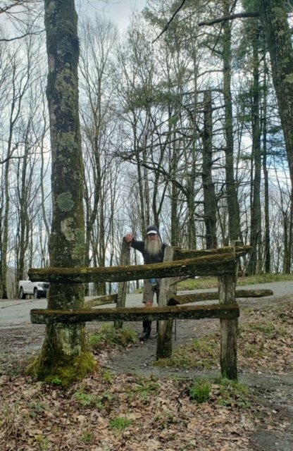
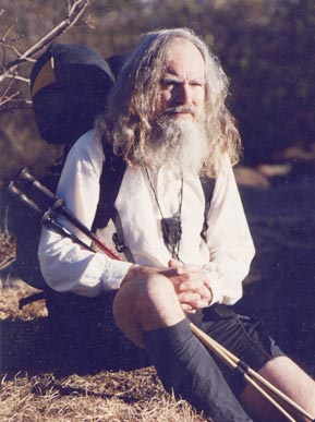
What an incredible experience, to have been there that day, that precise moment in time–to have met Arch, Dwight, Perry, Ed, and Jack, and to have had the opportunity and profound joy in becoming the first backpacker to stand in total awe atop the summit of Max Patch. Those old posts (the stile built 38 years ago at Max Patch Road) still stand–leaning and aged the least–like this old intrepid…
Commit thy way unto the LORD;
trust also in him; and he shall bring it to pass.
(Psalms 37:5 KJV)